Thursday, October 4, 2018
View the entire Google Web Album
One of the District’s three oldest parks, Tilden has been called the jewel of the system, and its recreational activities have become a happy tradition for generations of East Bay youngsters. From a carousel ride and a picnic to a swim at Lake Anza and a stroll through the Botanic Garden, Tilden has a variety to delight everyone. Yet there are plenty of quiet places in Tilden’s 2,079 acres to shelter the wildlife and preserve natural beauty. There are 39.41 miles of trails in Tilden Park, through many different kinds of terrain. The larger multi-use trails allow hikers, bicycles, and horses, some are for hikers and horses only, and the smaller single-track trails are for hikers only. *1
Claremont Canyon is the largest, relatively undeveloped canyon on the western slope of the Oakland/Berkeley hills. Most of the canyon’s 500-acre watershed is owned by public agencies, the East Bay Regional Park District, the University of California, the East Bay Municipal Utility District (east of Grizzly Peak Boulevard) and the City of Oakland (Garber Park), with one fifth held in private hands. The wildland landscape is currently a mosaic of vegetation types, mostly north coastal scrub and oak/bay woodlands, but also scattered grasslands, a few 100-year-old eucalyptus plantations, and a 40-year old redwood restoration area.*3
This hike explores the beautiful parkland at Tilden Park to the UC fire trail system around the upper watershed of Strawberry Creek to Panoramic Ridge at Claremont Canyon. Begin this hike from the Vollmer Peak Trailhead, located behind the Tilden Park steam train, provides access to Tilden Park trails, EBMUD trails, and UC’s fire roads & trails.*2
At the first trail junction, go left to stay on Vollmer Peak, it continues westward on a single track trail above the steam train yard.
Turn left at the next unmarked trail split, the trail drops down onto South Park Drive.
Continue left on S Park towards the Gillespie Youth Camp and turn right onto the paved Gillespie Camp Rd to Grizzly Peak. The fire trail winds through the beautiful oak/bay woodland.
Turn left at the unmarked Tower trail post to Grizzly Peak Trail, the single track continues through the dense woodland to the next junction.
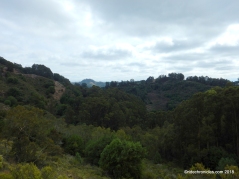
Turn right onto Grizzly Peak, it rolls through the scented eucalyptus stands and towering redwoods with views of the dense forest and surrounding hillsides.
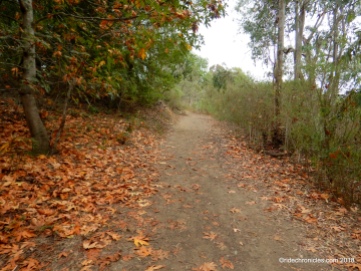
Enjoy some of the autumn colors!
At the next unmarked trail split, go straight to stay on Grizzly Peak Trail to its end at Golf Course Rd.
Turn left onto Golf Course Rd followed by another left onto Grizzly Peak Blvd. Stay on Grizzly Peak for about 1/10th of a mile, cross the road and make your way down the steps towards the cluster of Space Sciences Laboratory buildings. Follow the paved road and make a left across the last parking towards the UCB Fire Trail.
Turn right onto the unmarked UC Upper Jordan Trail, the broad fire road follows the upper watershed of Strawberry Creek at Strawberry Canyon.
At the first unmarked trail split, go straight to stay on Upper Jordan, the flat terrain winds along the gorgeous shaded canyon area to the 2.5-milepost.
The trail exits the woodland area with distant views of the bay.
At the next unmarked trail split, turn left, the trail tilts up with a moderate climb through the chaparral to the T junction at Panoramic Trail.
Turn right onto Panoramic Trail, it continues through the hillside brush to an open clearing.
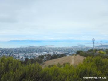
Enjoy the fabulous views of SF Bay!
Panoramic stays along the ridge with stunning views of the bay and beyond!
At the next trail split, go straight to stay on Panoramic, it continues along the ridge to another open clearing with grand views all-around!
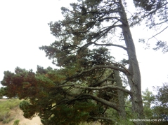
The trail drops downhill followed by a rolling climb up along the ridge towards the pine stands.
At the next trail split, go straight to stay on Panoramic to the top of Panoramic Ridge.
Enjoy the spectacular panoramic vistas of the entire SF Bay!
The trail comes to an end at Panoramic Pl. Follow the paved road downhill to the private gate.
Enjoy the phenomenal views!
Panoramic Pl continues downhill towards the Upper Jordan fire trail.
Turn right at the end of the road onto Upper Jordan Trail. The broad fire road turns easterly on flat terrain as it winds around the canyon area.
Upper Jordan continues through the eucalyptus grove and conifers with open views of the bay and canyon areas.
Turn right at the unmarked trail split and retrace the route back up to Panoramic Trail.
At the T junction, turn left on Panoramic followed by a left turn onto the unmarked Side Hill Trail. An unmarked, narrow trail called the Side Hill Trail angles off to the right through a small stand of French broom then transverses to a relatively undisturbed south-facing slope that features a wonderful array of spring and early summer wildflowers as it climbs gently to reach Grizzly Peak Boulevard at about 1,600 feet elevation. The Side Hill Trail intersects Grizzly Peak Boulevard about .8 miles north of Four Corners intersection with Claremont Avenue/Fish Ranch Road.*4
Cross Grizzly Peak Blvd to the green fire road gate and climb over into EBMUD watershed area. At the junction, turn left onto Skyline Trail.
Skyline Trail drops downhill through the scented oak/bay woodland and shrubland towards Tilden Park.
Cross Lomas Contadas and follow the Tilden Park signs for the return to Tilden Steam Train overflow parking lot.
This scenic hike takes you along the less traveled trails around the gorgeous canyons, ridges and watersheds with stunning panoramic views of the SF Bay and beyond!
Direction: Route will be Vollmer Peak Trail, Gillespie Camp Road, Grizzly Peak Trail, crossover Grizzly Peak Blvd., UCs Upper Jordan Trail, Panorama Trail, stopping to rest/snack at the bay view log. Return continues down the Panorama Trail, turn right back up the Jordan Trail, Side Hill Trail, cross back over Grizzly Peak Blvd., (CLIMB OVER A GATE) left on EBMUDs Skyline Trail back to the parking area. Water/flush toilets at nearby Steam Train parking lot, porta-potty at trailhead.*2
*1 https://www.ebparks.org/parks/tilden/
*2 http://hiking.bondon.com/MAIN.cfm?Page=HikeDetails&ID=1466
*3 http://www.claremontcanyon.org/history/
*4 http://www.claremontcanyon.org/map-trails/
Stats:
7.37 Miles with 1118′ of elevation gain
Max elevation: 1648′
Time: 3.25 hours with one stop
Hike: Moderate
Parking: No fee at Steam Train parking lot or gravel/dirt lot adjacent to Vollmer Peak trailhead
Water & restrooms available at Steam Train parking lot
Dog-friendly *except on EBMUD Skyline Trail
Bring plenty of water & snacks
Weather: Cloudy & cool. Temps ranged from the mid-high 60’s with WSW winds.
View the interactive RGPS route map & profile


