


Friday, January 30, 2015
View the entire Google Web Album
This route goes across the Benicia-Martinez Bridge into Solano County for a fairly flat ride out to Suinsun City and Grizzly Island Rd. Ride through Suisun Marsh-the largest single estuarine marsh in the US to Belden’s Landing and Rush Ranch Open Space.
Head north on Morello Ave to the outskirt of Martinez to Pacheco Blvd towards the refinery on Shell Ave.


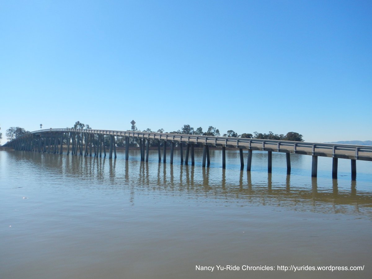
The RR Xing on Mococo Rd leads to the Benicia-Martinez Bridge Trail; it crosses Carquinez Strait with scenic views of the blue waterway and Franklin Hills. The path climbs for about a mile with an average grade of 4% followed by a quick descent onto Park Rd in Benicia.


Park Rd goes pass the Benicia Historical Museum towards the refineries to the industrial business parks along Industrial Way. This stretch of road provides great views of the remaining Mothball Fleet around Suisun Bay and the wetlands and marshes around Goodyear Slough.


Cross I-680 on Lake Herman Rd to Lopes Rd; this flat-rolling terrain hugs the I-680 corridor with beautiful views of the marshlands and sloughs along Grizzly Bay.


Lopes Rd goes through the residential subdivisions of Fairfield/Cordelia to Gold Hill Rd.


Cross over I-680 on Gold Hill Rd to Ramsey Rd; this less traveled side road goes along the east side of I-680 towards the I-80 junction in Cordelia. The wide open space is occupied with a few cattle ranches with long horns.


Cross the RR tracks at Old Cordelia and continue east on Cordelia Rd to the short climb up and over to the south edge of Green Valley.


Cordelia Rd leads us out to the open valley floor with nut orchards and rich agricultural farmlands.


Codelia Rd is closed for road work at Hale Ranch Rd; the detour horse shoes around the Budweiser plant on Hale Ranch Rd to Busch Dr and Chadbourne Rd. Chadbourne comes to a T at Cordelia Rd.


Cordelia Rd continues east along the edge of the industrial and business park area in Fairfield with fabulous views of the open fields and marshes.


Cordelia Rd enters the city limits of Suisun City onto Main St.


The Central County Bikeway from the Amtrak depot goes east along the north side of Hwy 12 to the Heritage Park Shopping Center.


Cross Hwy 12 and head south on Grizzly Island Rd; this road is the Gateway to the Suisun Marsh & Wildlife Area-“the largest single estuarine marsh in the Unites States”.


The flat terrain through Suisun Marsh crosses over Hill Slough.


Grizzly Island Rd continues on for a gentle climb up and over Suisun Hill.


The road drops down through the open ranch lands dotted with grazing cattle and magnificent views of Mt Diablo!


The flat terrain continues along the sloughs and marshes on the edge of Joyce Island with fabulous views of the green rolling Potrero Hills!


Grizzly Island Rd leads to the entrance to Belden’s Landing.


Enjoy the views of the surrounding wetlands and marshes along Montezuma Slough!


Reverse route back on Grizzly Island Rd to next stop at Rush Ranch; I manage to catch a shot of a kite hawk perched atop of a fence post-WOW!


Lunch stop at Rush Ranch Open Space:


Walk around the Visitors Center and enjoy the colorful murals and exhibits!


Return on Grizzly Island Rd back through Suisun Marsh over Hill Slough.


Reverse route on the bikeway back onto Main St and Cordelia Rd.


The climb up the other side of the hill on Cordelia Rd seems easier with great views of the valley below!


Return on Ramsey Rd to Gold Hill Rd and back along Lopes Rd.


Crossover I-680 and continue south on Goodyear Rd; this frontage road runs parallell to the freeway with fantastic views of Solano County’s wetlands and marshes. You can’t miss the views of Diablo either!


Retrace route on Industrial Way to Park Rd.


Cross over Carquinez Strait on the Benicia-Martinez Bridge and return through Pacheco to Martinez on Morello Ave.


This flat metric century explores some of the less traveled open roads along the gorgeous wetlands and marshes from Suisun and Grizzly Bays to the Suisun Marsh. Hit the road and enjoy the beautiful scenic rolling Potrero Hills to Belden’s Landing-the stop at Rush Ranch is a well worthy detour along Grizzly Island Rd!
Garmin Stats:
68.10 Miles with 1886′ of elevation gain
Max elevation: 213′
Max grade: 7%
Terrain: Flat-rolling
Weather: Light morning fog > Sunny with clear blue skies. Temps ranged from the mid 40’s to the high 60’s. NW winds with 76% humidity.
View the interactive RGPS route map & profile

Follow this route for today’s ride:
