


Wednesday, January 14, 2015
View the entire Google Web Album
Ride #2-South Bay Ramble: This ride heads NE for a climb up Leavesley and Roop to Coyote Lake at Harvey Bear Ranch County Park. Enjoy the beautiful out and back run along the lake to the dam on Coyote Lake Rd. The route continues on Gilroy Hot Springs to the green truss bridge over Coyote Creek followed by a gorgeous roll along Canada Rd.
We exit Uvas Pine onto Uvas Rd and head south along part of the Santa Clara Valley Wine Trail on Watsonville Rd to Day Rd.


Day Rd turns east for 3.4 gentle rolling miles through the open countryside ranches and pastoral meadows to Santa Teresa Blvd in Gilroy.


With a slight jog on Santa Teresa Blvd, Day Rd continues across the valley floor to Monterey Hwy.


Monterey Hwy is a busy thoroughfare through the town of Gilroy; the road runs parallel to the RR tracks for 2.3 miles south into Old Gilroy to E 6th St. E 6th St crosses over US-101 and name changes to Gilman Rd at Camino Arroyo.


Gilman Rd stays east along the open valley through the rich agricultural farmlands to Holsclaw Rd.


We head north on Holsclaw Rd; this road follows the curvatures of Llagas Creek to Leavesley Rd.


Leavesley Rd continues east along the valley orchards and pastoral fields to Crews Rd.


The left turn on Crews Rd takes us back onto Leavesley Rd. Leavesley Rd climbs from under the shaded woods with an average grade of 5.9% through Ruby Canyon for the next half mile up to the equestrian facilities at Coyote Springs and Crazy Horse Ranches.


Enjoy the gorgeous views of the upper valley!


Leavesley Rd continues winding around the ridge for the next 1.1 miles to the Hilltop Springs Ranch and Manfroy Ranch Rd with an average grade of 4% before descending onto Roop Rd.


Roop Rd climbs up under the shaded woodlands with an average grade of 6.2% for the next 0.8 mile towards Mendoza Ranch. The road drops down along the SE edge of Harvey Bear Ranch County Park with open views of the rolling hills and grassy ridges to the Coyote Lake entrance into the park.


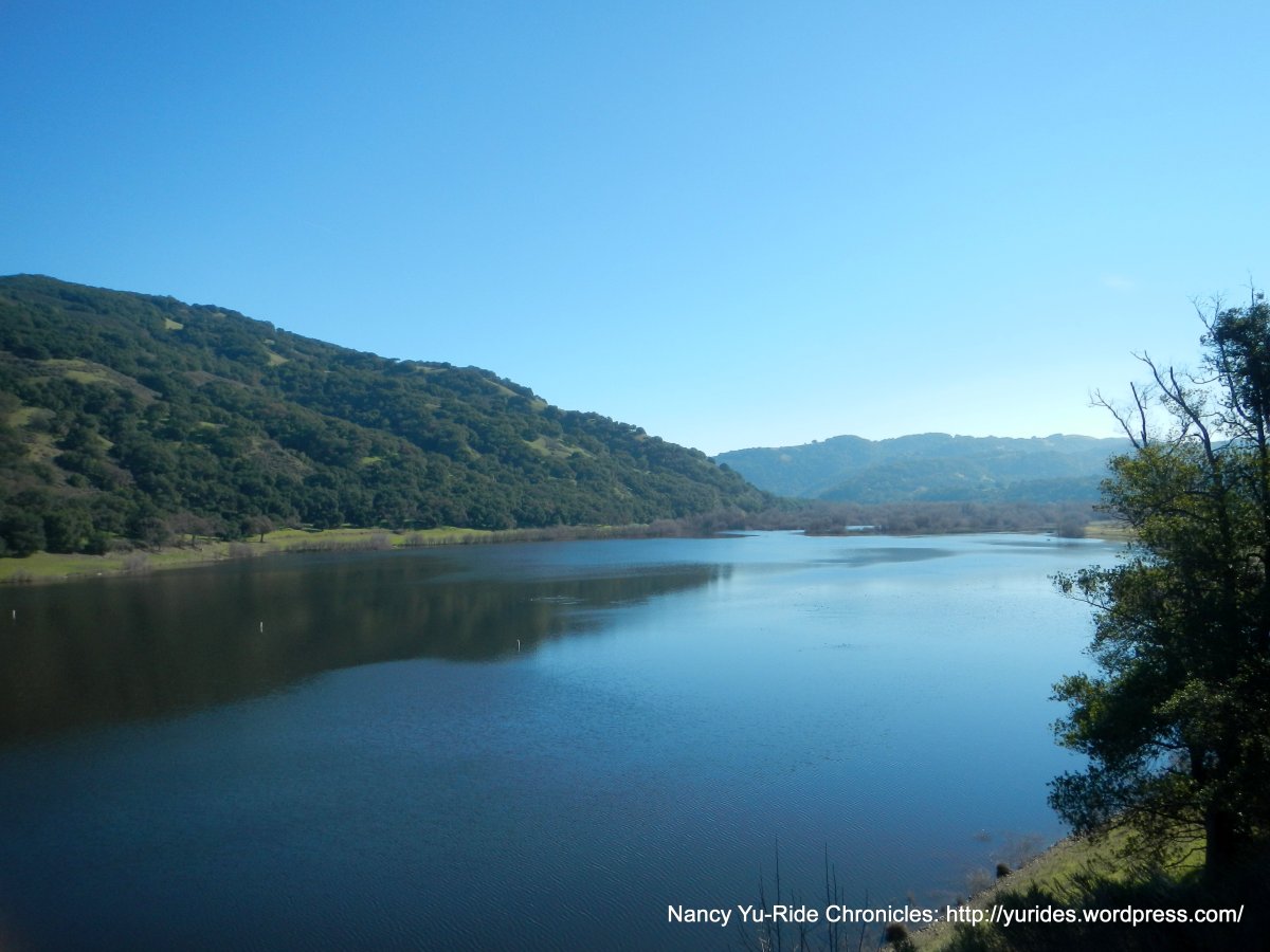
Coyote Lake Rd is not a through road; it stretches 4.2 miles through the country park from the south end along the western edge of Coyote Lake to the north end at Coyote Dam.


The gentle rolling terrain through the park has many picnic areas with scenic vistas of the lake and surrounding hills.


The road ends at Coyote Dam with fabulous views of the lake!


We exit the park and head east on Gilroy Hot Springs; the gentle rolling terrain follows along Coyote Creek for the next 2.7 miles through Dexter Canyon to the junction at Canada Rd with minimal to no traffic.


Gilroy Hot Springs continues north along the creek on a narrow single lane road for another 2.6 rolling miles.


The road ends at the green truss bridge over Coyote Creek. The Historic Gilroy Yamato Hot Springs has been closed for over 40 years.


On our way back along Gilroy Hot Springs, we stop at the Hunting Hollow staging area at Henry Coe State Park.


Canada Rd is a beautiful quiet back road; it stretches 8.8 miles from Gilroy Hot Springs to the south end at CA-152. The first 3 miles gently rolls though the hinterlands along Canada De Los Osos on a single lane road with wonderful views of the rolling hills and open green meadows.


Canada Rd comes to a T and continues SW on rolling terrain through the idyllic countryside ranch lands.


The road drops down from the top of the ridge onto the flat valley farmlands to CA-152. CA-152 is partially closed due to an overturned big rig!


We crisscross the valley on Ferguson and Dunlap to Holsclaw and Gilman Rd.


E 6th St takes us over US-101 through Old Gilroy out to the residential subdivisions on Wren and Welburn.


We take Santa Teresa Blvd back to west Day Rd and return to the RV Park on Watsonville and Uvas.


This fantastic ride takes you through the Santa Clara Valley out to the quiet countryside. You’ll enjoy the serene miles through the canyons and valleys with minimal to no traffic. The scenic loop from Leavesley Rd to Gilroy Hot Springs and Canada Rd is part of the Tierra Bella Bicycle Tour.
Garmin Stats:
56.24 Miles with 2664′ of elevation gain
Max elevation: 1056′
Max grade: 10%
Terrain: Flat-rolling with a few low hills
Weather: Sunny and cool with clear blue skies. Temps ranged from the low 40’s to the low 60’s. Mild NE winds with 71% humidity.
View the RGPS route map & profile

Follow this route for today’s ride:
