Sunday, April 15, 2018
View the entire Google Web Album
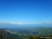
At the eastern fringe of the San Francisco Bay Region, Mount Diablo, elevation 3,849 feet, stands alone on the edge of California’s great Central Valley. At this point, the Coast Range consists only of low hills, none high enough to block the view from the upper slopes of the mountain. As a result, the view is spectacular.
Mount Diablo is a popular place to view the truly stunning scenery of coastal and central California-a kaleidoscope of deep bays, agricultural plains, and rugged mountains. To appreciate the physical aspect and spirit of Mt Diablo, explore it on foot and come into close contact with the plants and wildlife, the unique geology, even traces of forgotten history. An excellent system of trails is available to the adventurous ad to those who simply seek moments of peace and solitude to revitalize their spirit.*1
This hike climbs up to the summit of Mt Diablo from the Regency Gate Trailhead in Clayton. Ascend Donner Canyon and continue along Meridian Ridge up to Prospectors Gap. The climbing continues on North Peak Trail and Summit Trail to the summit of Mt Diablo State Park. Descend the mountain on Summit Trail and continue westward on Juniper Trail to Deer Flat and return north along Mitchell Canyon. Cross the expansive valley foothill on Oak Rd and Murchio Rd for the return on Back Creek to Regency Gate.
Begin this hike at the end of Mountaire Pkwy; descend the steep trail to the Regency Gate Trailhead.
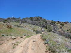
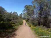
Go straight onto Donner Canyon Rd, it climbs up along the canyon up to Meridian Ridge Rd.
Turn right on Meridian Ridge.
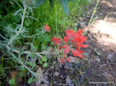
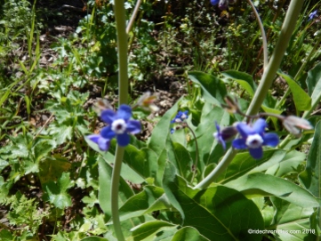
Wildflowers!
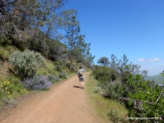
Continue up Meridian Ridge Rd to Prospectors Gap Rd.
Wildflowers!
Head SE on Prospectors Gap Rd, it goes onwards and upwards to the junction at Middle Rd.
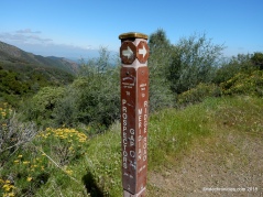
Stay on Prospectors Gap Rd to Prospectors Gap at 2960′ elevation.
Wildflowers!
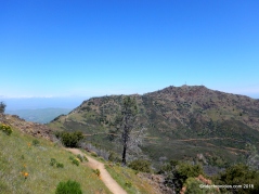
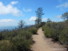
Across from the interpretive panel; turn right onto N Peak Trail. The narrow trail hikes up to the ridge and winds along the slope of the mountain.
Every turn opens up to dramatic views of North Peak and the expansive valleys below!
Wildflowers!
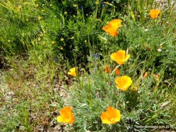
The trail continues along the exposed slope lined with a scattering of poppies and lupines to Devil’s Elbow.
Turn right onto Summit Trail. The trail continues up the mountain above Summit Rd to the Lower Parking Lot.
Cross Summit Rd and go straight to stay on Summit Trail. The trail cut through the dense woods and make its way up to the transmission tower before exiting out onto the Upper Parking Lot at the Summit.
Arrive at Mount Diablo Summit!
Many visitors to Mount Diablo head straight for the summit to enjoy the famous view. Summer days are sometimes hazy, and the best viewing is often on the day after a winter storm. Then, you can look to the west, beyond the Golden Gate Bridge, to the Farallon Islands; southeast to the James Lick Observatory on Mount Hamilton at 4,213 feet elevation; south to Mount Loma Prieta in the Santa Cruz Mountains at 3,791 feet elevation; north to Mount Saint Helena in the Coast Range at 4,344 feet, and still farther north to Mount Lassen in the Cascades at 10,466 feet. North and east of Mount Diablo, the San Joaquin and Sacramento Rivers meet to form the twisting waterways of the Delta. To the east beyond California’s great Central Valley, the crest of the Sierra Nevada seems to float in space.
The Visitor Center is located in the historic stone building atop Mount Diablo’s highest peak. The tower was constructed during the late 1930’s of fossiliferous sandstone blocks quarried in the park. The Visitor Center highlights the cultural and natural history of the park.
Telescopes are mounted on the deck to help visitors enjoy one of the finest views in the world. On the walk up the circular stairway to the observation deck, visitors are treated to a look at ancient marine fossils embedded in the sandstone walls of the Summit Building. In the rotunda they are reminded of Mount Diablo’s importance as a survey point. Above the rotunda is a beacon, historically important to aviators and now lighted once a year on December 7 in memory of those who lost their lives at Pearl Harbor.
Many visitors to Mount Diablo head straight for the summit to enjoy the famous view. Summer days are sometimes hazy, and the best viewing is often on the day after a winter storm. Then, you can look to the west, beyond the Golden Gate Bridge, to the Farallon Islands; southeast to the James Lick Observatory on Mount Hamilton at 4,213 feet elevation; south to Mount Loma Prieta in the Santa Cruz Mountains at 3,791 feet elevation; north to Mount Saint Helena in the Coast Range at 4,344 feet, and still farther north to Mount Lassen in the Cascades at 10,466 feet. North and east of Mount Diablo, the San Joaquin and Sacramento Rivers meet to form the twisting waterways of the Delta. To the east beyond California’s great Central Valley, the crest of the Sierra Nevada seems to float in space.
The Visitor Center is located in the historic stone building atop Mount Diablo’s highest peak. The tower was constructed during the late 1930’s of fossiliferous sandstone blocks quarried in the park. The Visitor Center highlights the cultural and natural history of the park.
Telescopes are mounted on the deck to help visitors enjoy one of the finest views in the world. On the walk up the circular stairway to the observation deck, visitors are treated to a look at ancient marine fossils embedded in the sandstone walls of the Summit Building. In the rotunda they are reminded of Mount Diablo’s importance as a survey point. Above the rotunda is a beacon, historically important to aviators and now lighted once a year on December 7 in memory of those who lost their lives at Pearl Harbor. *2
Magnificent views from the Observation Deck!
Retrace steps on Summit Trail to the lower parking lot and head west on Juniper Trail to Juniper Campground.
Go left to stay on Juniper Trail.
At Laurel Nook picnic area, turn right to stay on Juniper Trail to Deer Flat Rd.
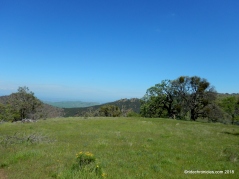
Go straight onto Deer Flat Rd, it exits the campground area and goes along the scenic Rock Ridge with panoramic views of Diablo Valley!
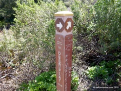
At Burma Rd junction, turn right to stay on Deer Flat Rd. It drops down from Rock Ridge to Murchio Springs at the Mitchell Canyon junction.
Turn left and head north on Mitchell Canyon Rd.
At Red Rd junction, go straight to stay on Mitchell Canyon Rd.
Head east on Oak Rd to Murchio Rd. Watch out for rattlesnakes!
Take Murchio to Back Creek Trail.
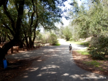
Continue on Back Creek for the return to Regency Gate and Mountaire Pkwy.
Mount Diablo State Park has an extensive network of trails and unpaved fire roads. The trails/road conditions vary, with some being broad and gently sloping and others narrow and steep. Hiking up to the Summit of Mt Diablo is a great way to immerse yourself around the park’s backcountry and enjoy the natural beauty of the mountain!
*1 http://www.parks.ca.gov/pages/517/files/mtDiabloBrochure.pdf
*2 http://www.parks.ca.gov/?page_id=517
Stats:
13.8 Miles with 3917′ of elevation gain
Max elevation: 3848′
Time: 5 hrs with one stop
Hike: Strenuous
Parking: Free street parking at the end of Mountaire Parkway in Clayton.
No facilities & no water. Descend steep trail to the park gate below.
Bring water & food/snacks-No amenities along the trails
NO DOGS ALLOWED
Weather: Sunny, cool and breezy. Temps ranging from the high 50’s to the mid 60’s with brisk SW winds
The current edition “Mount Diablo Trail Map” is available for purchase at the park entrance stations, Summit Visitor Center and Mitchell Canyon Visitor Center in Mt. Diablo State Park. They are also available at selected retail map distribution stores and on-line at MDIA’s Store.
Direction > Regency Gate > S-Donner Canyon Rd > R-Meridian Ridge Rd > L-Prospectors Gap Rd > R-North Peak Tr > R-Summit Tr > Mt Diablo Summit > U-Summit Tr to Lower Parking Lot > L-Juniper Tr >L-stay on Juniper Tr > R-Deer Flat Rd > r-stay on Deer Flat Rd > L-Mitchell Canyon Rd > R-Oak Rd > L-stay on Oak Rd > R-Murchio Rd > L-Back Creek Tr > L-Donner Canyon Rd > S-Regency Gate


