


Saturday, September 10, 2016
View the entire Google Web Album
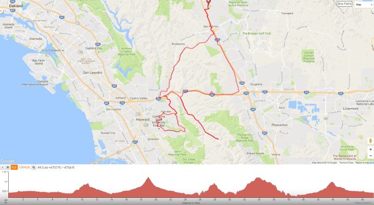
This urban semi-rural ride heads south along San Ramon Valley before turning westward up Dublin Hills followed by an out & back scenic stretch on Palomares Rd. The route continues south for a lollipop loop up Five Canyons Pkwy to Walpert Ridge on Hayward Blvd. The ride concludes with a quiet climb along Norris Canyon for the return through San Ramon Valley.
Exit Osage Station Park and Orange Blossom Way and El Capitan Dr to Camino Ramon; this frontage road runs along the west side of I-680 from Danville to Greenbrook Dr.


Crossover I-80 and head south on San Ramon Valley Rd into San Ramon. The flat-rolling miles on San Ramon Valley Rd goes through San Ramon and Dublin. At Alcosta Blvd, the road name changes to San Ramon Rd as it crosses into Alameda County.


Dublin Blvd to the summit at Dublin Hills Regional Park is 2.3 miles; the road begins on gentle terrain before kicking up to grades of 6-9% for half a mile starting from Silvergate Dr. The road levels out for a short 3/10ths of a mile up around the bend to Roys Hill Ln.


The road continues to climb for another mile with an average grade of 5.5% and steeper pitches of 9-11%.


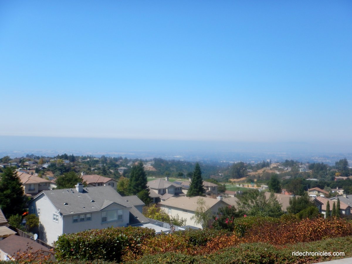
Dublin Hills Regional Park Donlon Point Staging Area at Schaefer Ranch.


Continue on Dublin Blvd for the steep drop on Schaefer Ranch Rd to Dublin Canyon Rd. Turn right and head west through Dublin Canyon to Palo Verde Rd and Palomares Rd.


Palomares Rd stretches 5.1 miles from Palo Verde Rd to the summit. The gentle rolling terrain for the first couple of miles on this beautiful quiet back road takes you through the many horse ranches and wooded canyon along Palomares Creek.


The rolling terrain leads up to the narrow bridge crossings.


You’ll come upon the steeper sustained climb up to the summit after the second creek crossing; it begins at mile marker 4.05 with grades of 7-8% and steadily increases to grades of 9-12% as you reach mile marker 4.74. It maxes out at 13% as you approach the turn at the yellow right arrow sign.


A portion of Palomares Road will be closed for an extended period of time beginning August 3 in order to complete a bridge replacement over Stonybrook Creek. During construction, Palomares Road between mile post 8.70 and 8.50 will be closed to thru traffic through October 26. The closure will block traffic access along Palomares Road accessed from Niles Canyon Road/Hwy 84. Drivers, bicyclists, and pedestrians will be unable to use Palomares Road to travel between Niles Canyon/Hwy 84 and Hwy 580 for the duration of the work and will need to take alternative routes. *1
Turn around at the summit and descend Palomares Rd. Turn left on Palo Verde Rd and continue on E Castro Valley Blvd. The road runs under I-580 towards Castro Valley to Five Canyons Pkwy.


Five Canyons Pkwy travels 2.3 miles southward through the Five Canyons subdivisions to Fairview Ave. The road drops down under I-580 followed by a steep climb with grades of 8-16% up to Boulder Canyon Dr.


Five Canyons Pkwy drops down for a short bit followed by another steep 8-16% climb up to Five Canyons Park.


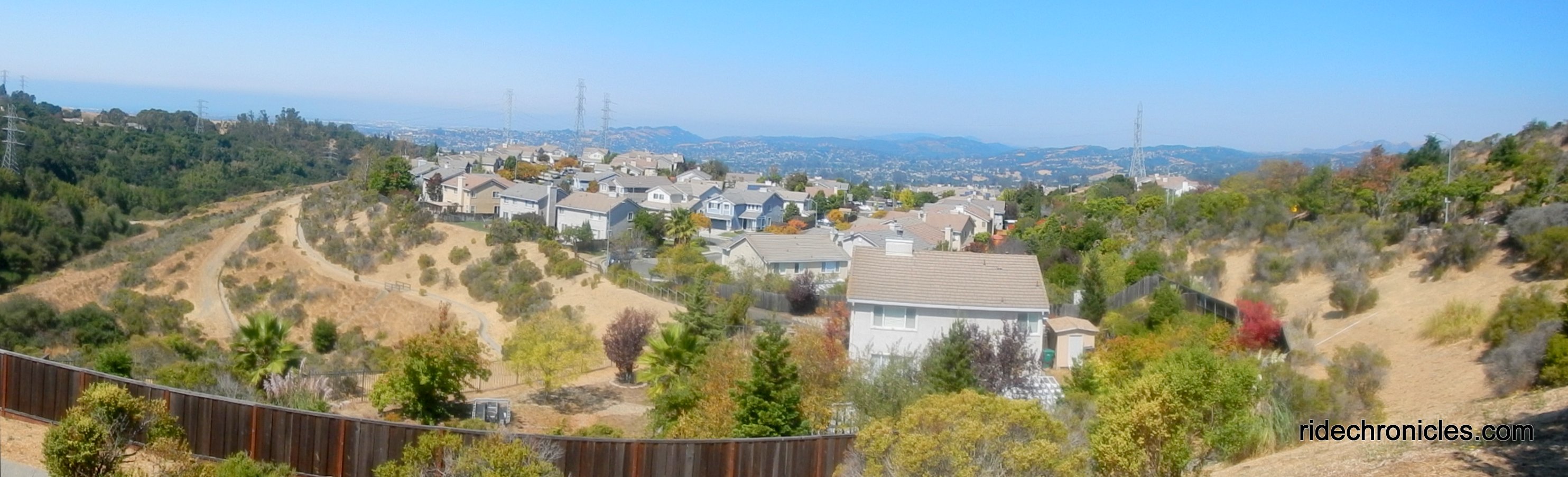
Stop at Five Canyons Park.


The road continues uphill to the south end of Five Canyons subdivisions to the traffic circle at Fairview Ave.


Turn right onto Fairview Ave, the road drops downhill to Lone Tree Cemetery on Hansen Rd. Meander around the city streets on East Ave, Winfeldt Rd, and 2nd St into the city of Hayward.


Head south on Campus Dr, the road snakes uphill over Ward Creek to the California State University East Bay campus on Hayward Blvd.


Turn right onto Hayward Blvd, the road turns eastward along the north edge of the university past the residential developments to Civic Ave.


The road kicks up for a steep half mile climb to Parkside Dr with an average grade of 11%!


Hayward Blvd levels out for a short bit before continuing uphill with a gentler climb towards the residential neighborhood around JA Lewis Park.


The road continues climbing on a narrow lane with steep grades of 9-11% to the Stonebrae Country Club homes on Walpert Ridge.


At the traffic circle, turn left onto Fairview Ave, the road heads north along the ridge past the hilltop homes to Five Canyons Pkwy.


Return on Five Canyons Pkwy, the road drops down into the canyon followed by a short stiff 10-12% climb back up to E Castro Valley Blvd.


Take E Castro Valley Blvd to Crow Canyon Rd, the road leads you out of Castro Valley as it heads north along Crow Creek to Norris Canyon Rd.


Turn right onto Norris Canyon Rd, the road begins with a gentle ascent for the first mile along Norris Creek.


At mile marker 1.18, the road kicks up to a steady climb for the next 0.8 mile with an average grade of 8% along with steeper pitches of 10-11%!


You’re near the summit when you see the hilltop ranch at the Alameda/Contra Costa county line.


The road descends swiftly through the canyon along San Catanio Creek and rolls back through the residential neighborhoods to San Ramon Valley Blvd.


Return north along San Ramon Valley Rd and cross I-680 on Greenbrook Dr to Camino Ramon and Osage Station Park.


This local ride takes you along the city streets out to the quiet back roads on Palomares Rd and Norris Canyon. It also gives you a chance to explore the “burbs” from Five Canyons out to Stonebrae Country Club.
*1 http://www.acgov.org/pwahome/pub/documents/news/PalomaresRoadClosurePublicMeetingNotice.pdf
Garmin Stats:
49.44 Miles with 4442′ of elevation gain
Max elevation: 1129′
Max grade: 16%
Terrain: Hilly with steep climbs
Weather: Sunny and warm! Temps ranged from the high 50’s to the mid 80’s with NW winds.
View the interactive RGPS route map & profile
Follow this route for today’s ride:
