Wednesday, May 28, 2014
View the entire Google Web album
Today’s route explores the usage of the Multi-use paths from Larkspur, San Rafael, Greenbrae and Corte Madera to Mill Valley and Sausalito. This ride includes a beautiful loop around the Marin Headlands on Conzelman up to Hawk Hill and continues on Bunker Rd to the Coastal Trail above Rodeo Beach. A jaunt around the Tiburon Peninsula along Paradise Dr completes this eastern Marin County shoreline tour.
This ride starts at the Marin Country Mart to the Cal Park Path & Tunnel; the entrance onto the pathway from the south end at Larkspur Landing is located behind the Cinemark Larkspur Landing Theater. The pathway/tunnel runs 1.1 miles on an old railroad tunnel; it cuts through the hill and provides a connection from Larkspur to San Rafael and vice versa.
The pathway exits onto Andersen Dr at the north end in San Rafael. We continue NW on Andersen Dr through the industrial area to the residential neighborhoods along Bret Ave and Irwin St.
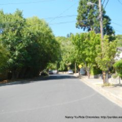
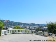
Irwin St winds its way under a canopy of trees along Southern Heights Ridge through the hillside homes with fabulous views of San Pablo Bay and San Rafael.
The road becomes Tiburon Blvd as it gently rises up towards the residential homes; it drops down to Via La Cumbre followed by an immediate short steep pitch to the top of the ridge.
Via La Cumbre drops us down into Greenbrae onto Eliseo Dr and Sir Francis Drake Blvd. We hop onto the Multi-use path off Del Monte; this path parallels US-101 and exits onto Nellen Ave to Corte Madera.
The slight jog along Nellen and Fifer leads us onto Tamal Vista Blvd; we head south along Tamal Vista through the business/commercial district of Corte Madera out to the Town Center shopping mall.
We cross Tamalpais Dr and continue south on Casa Buena Dr; this frontage road climbs parallel to US-101 and exits onto the Mulit-use path leading to Lomita Dr.
Lomita Dr takes us through the edge of a residential neighborhood onto the Mill Valley-Sausalito Path to E Blithesdale Ave in Mill Valley.
We stay on the Mill Valley-Sausalito Path; it takes us along the waters around Pickleweed Inlet from Bayfront Park to Bothin Marsh Preserve.
The path continues under Richardson Bay Bridge towards the harbor and Richardson Bay Marina.
We exit the path onto Gate 6 Rd and head south on Bridgeway through the busy tourist town of Sausalito.
The climb up along 2nd St to South St and Alexander Ave leads us out-of-town towards the north end of the Golden Gate Bridge.
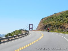
The tunnel crossing under US-101 on Alexander Ave takes us onto Conzelman Rd to the Marin Headlands; the protected open spaces around the Golden Gate National Recreation Area.
The climb on Conzelman Rd up to Hawk Hill is 1.8 scenic miles; it can be broken down into three sections. The first 3/10th of a mile is the steepest with an average grade of 9.65%.
The second section eases up a bit for the next 0.9 mile; it leads up to the traffic circle at McCullough Rd with an average grade of 3.5%.
The third section kicks up with an average grade of 6% for the 0.7 mile to the summit at Hawk Hill.
Stop and enjoy the spectacular views!
The descent on Conzelman Rd to the lower Coastal Trail parking lot is very steep with 18% grades-be cautious!
Conzelman Rd continues along the ridge towards the old concrete batteries-Battery Rathbone/McIndoe at Fort Barry.
We stay on Conzelman Rd and continue on Field Rd towards Point Bonita.
At the circular lot on Field Rd, we take the gravel road on Mendell Rd to the Vista Overlook above Bird Island. This area has spectacular views of the Golden Gate, Point Bonita Lighthouse, Bird Island, Rodeo Cove and Rodeo Beach!
We exit the Overlook Area and make our way down to Bunker Rd towards the Marine Mammal Center.
At the end of Bunker, we continue on the Coastal Trail through the closed gate; this counter clock wise loop takes us up and around the headlands below Wolf Ridge to the summit at Battery Townsley.
The Coastal Trail drops down from Fort Cronkhite onto Mitchell Rd to Rodeo Cove with gorgeous views of the lagoon and beach areas.
We stop for lunch at Rodeo Beach-enjoy the views and take in the fresh ocean air!
Mitchell Rd leads us out from the beach area along the lagoon to Bunker Rd.
We continue east through the valley on Bunker Rd to the single lane tunnel.
At the other end of the tunnel, Bunker Rd drops down towards Fort Baker at Cavallo Point.
East Rd takes us pass the US Coast Guard Station and the Discovery Museum for the climb up to Alexander Ave.
From Alexander Ave, we retrace our way back through Sausalito on Bridgeway to the Mill Valley-Sausalito Path.
We exit the Mill Valley-Sausalito Path onto another Multi-use path through the soccer field at Hauke Park to Hamilton Dr.
We head south on Hamilton Dr and make our way around Richardson Bay on Seminary Ave.
The short climb on Strawberry Dr takes us through an affluent community around Strawberry Point.
We drop down on Harbor Cove Way and take the narrow pathway around the townhouses along Richardson Bay to Greenwood Cove Dr.
Greenwood Cove Dr becomes Greenwood Beach Rd as it winds up along the bay to Blackie’s Pasture.
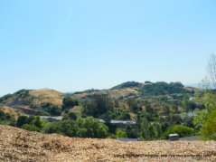
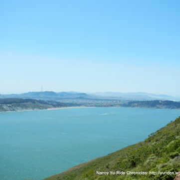
We continue on the Tiburon Linear Park path through McKegney Field with fantastic views of Richardson Bay and beyond!
The path exits onto San Rafael Ave in Belvedere; this road goes along the shoreline of Richardson Bay to Beach Rd with great views of Mt Tamalpais.
Beach Rd goes through a residential neighborhood along Belvedere Cove to the old downtown area on Main St in Tiburon.
We make a brief stop at Caffe Acri for a cold drink and apricot jam cookie.
Take a walk along Shoreline Park to enjoy the wonderful views of the City and SF Bay!
Paradise Dr runs 8.4 rolling miles from Tiburon to Corte Madera; it snakes around the Tiburon Peninsula along the edge of the Uplands Nature Preserve, the Romberg Center and the Paradise Beach County Park beforedropping down onto the flatlands.
The Multi-use path off Paradise Dr from Corte Madera takes us along marsh lands around the edge of The Village shopping center to Redwood Hwy.
We stay on Redwood Hwy and take the Mulit-use path along the off ramp from US-101 to Sir Francis Drake Blvd in Larkspur. The path continues along the Ferry Terminal to the upper ramp/walkway; this leads us back to the Marin Country Mart.
A ride around the Marin Headlands is a must-do if you’re in the SF/Bay Area! You’re greatly rewarded for the climb up Conzelman Rd with breathtaking views of the Pacific Ocean, the City and beyond and the iconic Golden Gate Bridge! The natural beauty that surrounds us is available for free-make and take the time to enjoy it!
Garmin Stats:
52.60 Miles with 3268′ of elevation gain
Max elevation: 813′
Max grade: 11%
Terrain: Some hills with one steady climb up Conzelman
Weather: Sunny, warm and clear with temps ranging from 64F in the morning to an afternoon high of 86F. NW winds with 30% humidity
Click here to view the interactive route map & elevation profile
Follow this route for today’s ride:













Nancy, What a fantastic narrative to a really stunning route! Thanks! jim
Jim, Riding around the headlands is one of my favorites routes in the Bay Area! nancy
LikeLike
Agree with earlier comment. Always look forward to your latest blog entry. Blackie’s Pasture looks lovely. You’re a great ambassador for showing us the natural wonders of the Bay Area.
Mrs Barnes, Thanks for your lovely comments-it’s much appreciated! Nancy
LikeLike
I am so inspired to go ride and check out that 68-ft long barrel! Always a source of inspiration Nancy and Michael
LikeLike
Thanks, Rinaldi! Get out and enjoy the fabulous weather we’re having!
LikeLike