Saturday, April 19, 2014
View the entire Google Web album
We’re out to do something different today; this mixed terrain ride follows the rocky dirt road on Old Railroad Grade up Mt Tamalpais to West Point Inn and to the mountain summit at East Peak. We’ll descend the paved roads on Ridgecrest Blvd to Pan Toll and Panoramic Hwy to Mill Valley.
The first 1.5 flat miles on Miller Ave takes us through Mill Valley’s busy little downtown area around Depot Plaza.
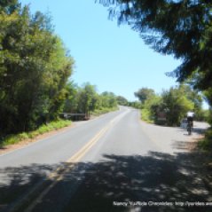
W Blithesdale Ave is a narrow single lane road that roughly follows along the Corte Madera Del Rprsidio Arroyo creek through a beautiful residential neighborhood nestled between the towering redwoods.
The road continues underneath the woods to Blithesdale Park.
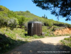
Near the far north end of Blithesdale Ave, we cross the wooden gate entrance onto Old Railroad Grade. The rocky dirt road heads out under a gorgeous canopy of dense redwoods and winds its way through the woods.
The road opens up to the blue skies above with fantastic views of the surrounding forest greens.
There are some sprinkling of pretty wildflowers in bloom along the mountain:
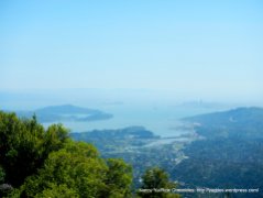
The road continues up to Summit Ave with phenomenal views of the SF/Bay Area! There is a small lookout area with a bench; stop and look back on the road you came up on and enjoy the views-WOW!
We cross the steel gate onto a short section of loose gravel to Fern Canyon Rd. The paved road on Fern Canyon winds up and around a residential neighborhood before leading us back to Old Railroad Grade.
The dirt road weaves up along the mountain side with stunning SF/Bay views!
We continue up the mountain through a myriad of twists and turns with stunning views of the surrounding mountains and dense forest.
The road winds in and out of the woods with breathtaking views!
You’re near the trail junction when you see the overhanging wooden cottages at West Point Inn. The views changes at every bend up along the mountain-amazing!
West Point Inn is a popular stop for hikers and bicyclists year-round; take a break and have a seat at one of outdoor picnic tables or buy something to drink or eat and enjoy the views from the outdoor deck area.
We stay on Old Railroad Grade around the west side of the inn and continue on the gentle uphill to East Peak.
At the end of the road, we cross the steel gate onto Ridgecrest Blvd and take the paved Old Railroad Grade Trail up to the summit.
We stop for lunch at the east end of the summit at Verna Dunshee Trail picnic area. Take the time to enjoy the views!
From the summit, we’re taking the paved roads back down to Mill Valley. Of course, you can also reverse the route and descend Old Railroad Grade-it’s all a matter of preference!
Before descending the mountain, we must first climb out from the bottom of upper parking lot for about a mile up to the high point; it’s a series of short humps with 7-10% grades.
The downhill on Ridgecrest Blvd is fun but it can also get very fast around the turns-know your skills! The descent on Pan Toll Rd winds around the ridge with super views of the ocean-at the upper turns, it looks as if you can fly off the mountain!
At the bottom of Pan Toll, the downhill continues SE on Panoramic Hwy to Four Corners. The drop down Sequoia Valley Rd to Edgewood takes us along the residential neighborhoods to the bike route on Janes St back to Miller Ave. taking Janes St is a nice detour away from the cars coming down Molina Ave onto Miller.
This gorgeous mixed terrain ride offers phenomenal views as you snake your way up and down the mountain. The dirt road has gentle 4-5% grades with plenty of space for bicyclists and hikers to get around each other. Stop at the many vista points to enjoy the amazing views of Marin County, the East Bay and San Francisco! On a clear day, you can see the three bridges; the Richmond-San Rafael Bridge, the Bay Bridge and the iconic Golden Gate Bridge! If you’re looking to switch things up a bit, this would be a great route to try.
Garmin Stats:
21.45 Miles with 2884′ of elevation gain
Max elevation: 2556′
Max grade: 10%
Terrain: Hilly-rocky dirt trail and paved roads
Weather: Sunny and warm with clear blue skies. Temps ranged from the mid 50’s to the mid 80’s. Mild W winds with 63% humidity
Click here to view the interactive route map & profile
Follow this route for today’s ride:


