Friday, September 13, 2013
View the entire Google Web Album
Today we’re doing a local urban century out to Sunol for the gentle climb up to the summit of Calaveras Rd. The route heads south along the flats on Danville Blvd to the gentle rollers on San Ramon Valley Rd and San Ramon Rd into Dublin. Foothill Rd begins from Pleasanton all the way to the other end in Sunol. The return includes an easy 10 mile run along the Iron Horse Trail and Canal Trail back to Martinez.
We take our standard way out of Martinez on Morello Ave to Pleasant Hill and go up and over Taylor Blvd into Lafayette. Taylor Blvd has a 0.4 mile 8-9% climb up to the top at Rancho View Dr. It becomes Pleasant Hill Rd as you descend into Lafayette to Olympic Blvd.
The classic way to Danville Blvd is via Olympic, Newell, Lilac and Lancaster to Castle Hill; it weaves through the residential neighborhoods of Walnut Creek to S Main. Danville Blvd is the main thoroughfare through the towns of Walnut Creek, Alamo and Danville. During the weekdays, the road is clogged with commuter traffic and parents in their SUV’s and minivans dropping off their kids at school.
San Ramon Valley Rd takes us pass the busy shopping centers, strip malls, business districts and residential neighborhoods around Danville and San Ramon. The road parallels I-680 all the way into Dublin.
San Ramon Rd from Dublin continues south through the parks, schools, residential subdivisions and shopping centers towards the I-580 interchange. Pay attention to all the traffic entering and exiting the freeway on and off ramps-ride with caution!
The next 8.5 miles on Foothill takes us pass Stoneridge Shopping Center, Foothill High School and the many residential neighborhoods in Pleasanton. Once you pass Bernal Ave, the homes become larger estate around Castlewood Country Club and Amador Valley. Foothill Rd continues on the east edge of Pleasanton Ridge Regional Park with oak studded grasslands along the Arroyo de la Laguna into the town of Sunol.
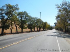
The flat stretch on Paloma Way has fabulous views of the open fields and hillsides around Sunol Valley.
Paloma Way becomes Calaveras Rd at the I-680 underpass. The first 4.2 flat rolling miles continues through Sunol Valley; this area is currently experiencing a lot of heavy truck traffic due to the Water System Improvement Program for the San Antonio Backup Pipeline Project.
We pass the gravel pits around Cemex Sunol Quarry, the rows of neatly lined plants and trees at Calaveras Nurseries and the beautiful mature trees at Valley Crest Tree Company. We also spot a good sized tarantula crossing the road; surprisingly it didn’t get run over by the large hauling trucks that just passed us! We pulled over to the side and Michael nudged it away from the road onto the embankment.
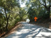
Calaveras Rd crosses over Welch Creek towards Sunol Regional Wilderness to the intersection at Geary Rd. The climb up to the false summit begins here; it’s 2.7 miles with an average grade of 4%. The road weaves in and out of the trees surrounding the wilderness area with fantastic views of the ridgelines and hillsides above!
The rolling descent drops us down towards the reservoir for the rolling climb up to the high point of Calaveras at 1124 feet. The road snakes in and out of the woods with views of the reservoir.
Calaveras continues out to the open back ridge on a single narrow lane with gorgeous views of the reservoir and Calaveras Valley!
We opt to turn around at the summit before the drop down “the wall” and stop for lunch under the shade of the large tree at 4010 Calaveras Rd.
From the summit, we simply reverse our way back on Calaveras Rd to the climb back up to the false summit. The sweeping descent drops us back to the creek crossing to the rolling flats into Sunol.
We stop at the Sunol Train Depot to check out the chartered train ride to Niles Canyon. It’s a blast from the past to see the beautiful bright red caboose, the open viewing cars and the fully enclosed coach pulled by the classic Western Pacific locomotive.
On the return to Martinez, we discovered a great find at our stop at the Alcosta Chevron Station off San Ramon Valley Rd. This place has a Bike Fixtation-complete with bike racks, a work bike stand, a floor pump and a vending machine full of bike essentials; chamois butter, Tri Flow lube, different size tubes, energy bars, sunscreen, Co2 and even batteries! WOW!
From Danville Blvd in Walnut Creek, we take Rudgear Rd to S Broadway and hop onto the Iron Horse Trail at Newell Ave. We cross the trestle style bridge over the creek and Arroyo Way to another bridge over Ygnacio Valley Rd. The 6.2 miles on the Contra Costa Canal Trail takes us back to Martinez.
The weather has been so wonderful lately, it’s great to be able to just leave from our front door and hop on the bike for a ride! We had our first Tarantula sighting for the season and found out about the Bike Fixtation at the Chevron Station-2 great finds in one day! Keep that in mind whenever you’re riding out that way.
This is my 50th Century for this year-today is also Friday the 13th and I felt lucky all day long-Life is worth celebrating on a daily basis!
Garmin Stats:
100 Miles with 4843′ of elevation gain
Max elevation: 1104′
Max grade: 9%
Terrain: Mostly flat to rolling with one gentle climb
Weather: GREAT! Partly cloudy in the morning turning to bright sunny skies and warm temps ranging from the mid 50’s to the high 80’s. SW winds with 39% humidity
>>>>>>>>>>>>>>>>>>>>>>>>>>>>>>>>>>>>>>>>>>>>>>>>>>>>>>>>>>>>>>>>
You don’t have to go fast, you just have to go.
>>>>>>>>>>>>>>>>>>>>>>>>>>>>>>>>>>>>>>>>>>>>>>>>>>>>>>>>>>>>>>>>
Click here to view the interactive route map & elevation profile
Follow this route for today’s ride:


Nancy, Congratulations on your 50th Century this year! Get a Voler jersey designed/made and package it with all 50 routes printed and for sale. (Suggested retail $100.00). I think you’d be surprised at the interest!
jim
Thanks Jim! I still have 2 more to go!
LikeLike
Sorry to learn about Joy Covey . . Stay safe out there
Thanks James! Safety is always my #1 concern.
LikeLike