Saturday, April 27, 2013
View the entire Google Web Album
The Wine Country Century is organized by SRCC and is one of the most popular cycling events in Northern California. This century winds through redwoods, apple orchards and shady forest, crosses the Russian River pass the many different wineries and vineyards along Russian River Valley, Green Valley, Dry Creek Valley, Alexander Valley & Chalk Hill. It’s always sold out-so why not ride it on our own? Today, we’ll be following the exact same route with the start/finish at Esposti Park in Windsor.
We head south on Old Redwood Hwy and turn west on River Rd; the first 17 miles meanders across the valley floor on flat to rolling terrain through vineyards, apple orchards, open meadows, cattle ranches and a few residential neighborhoods.
The 4.8 mile stretch on Graton Rd cuts through the valley along Purrington Creek with scenic views of the vineyards before heading up through the wooded hills around Graton to Occidental. The 2 mile climb begins gradually with gentle grades of 3-4% and steadily increases to 6-8% as you near the top. The short descent drops down along the valley out to Bohemian Hwy in Occidental.
The fun 6+ miles of rolling descent through the beautiful redwoods and wooded forest along Bohemian Hwy takes us out to the Russian River at Monte Rio. We continue north through the flat rolling terrain of the river valley on River Rd/Hwy 116 into the town of Guerneville for our first stop at Safeway.
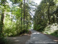
By now, the sun is up and it’s warming up quite nicely! We cross the Russian River on Hwy 116 out of Guerneville for the turn onto Mays Canyon Rd. The very gentle climb through the canyon takes us under a gorgeous canopy of trees out to the vineyards of Porter Bass Winery. The road drops down to Hwy 116 where we head SE for the turn on Green Valley Rd.
Green Valley Rd goes on for 6.9 miles; the first mile through the woods of Oregon Canyon is fairly gentle followed by immediate steep grades of 8-12% as we make our way around the switchbacks up to the summit.
The descent takes us through the horse ranches, farm houses and acres of vineyards along Green Valley and continues to the town of Graton for the short pitch up to the crossing at Hwy 116.
Vine Hill Rd takes us towards Forestville up along the ridge with fabulous views of the vineyards with the Sonoma Mountains in the background-WOW!
We continue north on Laguna and Trenton Rd and cross River Rd at Trenton Healdsburg Rd. The Russian River Valley tour of the vineyards begins along Trenton Healdsburg Rd to Eastside, across the Wohler Bridge and on Westside Rd. This valley offers spectacular views of all the surrounding vineyards and beautiful wineries and estates-it’s gorgeous!
The 8.8 miles along W Dry Creek Rd takes us further north through the vineyard appellation of Dry Creek Valley. This area offers even more scenic views of the many vineyards and wineries! We cross the Yoakim Bridge and take Dry Creek Rd to our lunch stop at Lake Sonoma.
We return on Dry Creek Rd has wonderful views of the surrounding mountains, vineyards and olive groves.
The short climb on Canyon Rd up to Olive Hill Cemetery, the descent drops us into the town of Geyserville.
We continue on Hwy 128 and meander through the magnificent wineries and vineyards along the valley floor of Alexander Valley. The surrounding landscape offers spectacular views of the Mayacamas Mountains-the scenery is remarkable!
The last climb of the day is up Chalk Hill Rd; this road crosses the Historic Maacama Creek Bridge and continues through the valley with great views of the vineyards, wineries and horse ranches. The road gradually climbs up under a canopy of trees with grades of 6-7% up to the top and descends down the other side of the valley.
Chalk Hill Rd continues on with a few more short pitches up and over to the open vineyards along Faught Rd. We take Shiloh Rd back to the finish at Esposti Park.
This is a beautiful scenic century through the Wine Country of Sonoma County. Skip the stress of trying to get an event registration and get a bunch of friends together and just ride!
Garmin Stats:
100.03 Miles with 4633′ of elevation gain
Max elevation: 532′
Avg grade: 3%
Max grade: 15%
Weather: FABULOUS! Cloudy and cool with the morning temp at 45F. Sunshine after 10 AM with temps reaching 86F. Mild SW winds
>>>>>>>>>>>>>>>>>>>>>>>>>>>>>>>>>>>>>>>>>>>>>>>>>>>>>>>>>>>>>>>>>>>>
Without new experiences, something inside of us sleeps. The sleeper must awaken. ~Frank Herbert
>>>>>>>>>>>>>>>>>>>>>>>>>>>>>>>>>>>>>>>>>>>>>>>>>>>>>>>>>>>>>>>>>>>>
Click here to view the interactive route map & profile
Follow this route for today’s ride:


