


Sunday, April 28, 2013
View the entire Google Web Album
This out and back ride begins on Mines Rd in Livermore at the wide dirt parking area about a tenth of a mile from the Y intersection with Del Valle Rd. This route stays on Mines Rd for 25 miles to the Junction Café for lunch and continues out an extra 2 miles on San Antonio Valley Rd in search of elk and wildflowers.
Mines Rd is a remote road with no facilities until you reach the Junction at the Junction Café. This less traveled road is very popular with motorcycle groups as well as cyclists and bird watchers.


The first few miles up Mines have several climbs with gradient ranges of 5-8% and a few steeper sections with pitches of 9-11%. The weather is a huge factor on this road, on hot days you can get cooked under the full exposure of the sun. Be prepared and bring snacks and enough water to get you to the Junction.


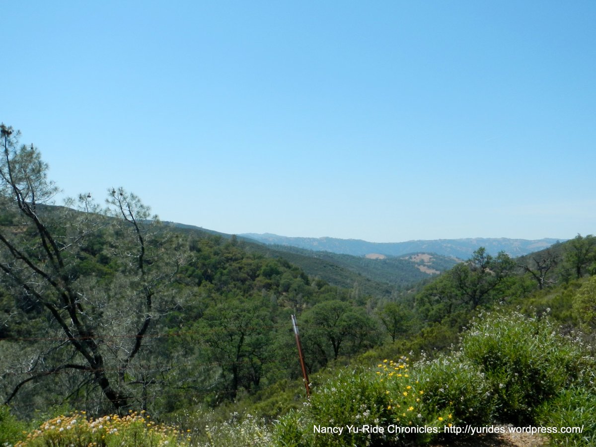
The road narrows as the terrain levels out along the ridge out to the valley floor. The valley is home to a few horse ranches and private residences tucked away from the main road. The lack of rain during this spring season results in the no-show of wildflowers in the meadows.


Take the time to enjoy the Sierra like landscape and the beauty of the mountains of the Diablo Range. Mines Rd follows the Arroyo Mocho stream out to the Santa Clara County line. The flat miles along the valley are followed by a climb up to the Ruthy sign at the top of the gap.


The sweeping descent down the canyon is followed by another short steep climb up to the open ranch at the summit. The road descends to the valley out to the Junction Café.


After lunch, we continue on San Antonio Valley Rd for a few miles in search of wildflowers and elk. Neither can be found, it’s really dry out here! We do see a bald eagle soaring high above us. We turn around at the point before the road drops down to the bridge on the other side.


On the return, the previous descents are now climbs; the first climb out is about 2 miles long with 3-6% grades. The second climb up to the Ruthy gap is a little over a mile long with 5-7% grades.


The fast descent drops us back down to the flats along the valley and to the rolling terrain along the ridge. The mild headwinds provide a welcome breeze to the warm ride back to the start. I love riding my bike!


Thanks to Stephanie and Janet for leading the ride!
~20 people in attendance with 2 tandems
Garmin Stats:
55.41 Miles with 3986′ of elevation gain
Max elevation: 621′
Avg grade: 3%
Max grade: 12%
Weather: FANTASTIC! Sunny and hot with clear blue skies. Temps ranged from the mid 80’s to the low 90′ with mild NW winds
>>>>>>>>>>>>>>>>>>>>>>>>>>>>>>>>>>>>>>>>>>>>>>>>>>>>>>>>>>>>>>>>>>>>
I’m drawn to the open country. It’s where everything is clear, where the world makes the most sense. When I put myself out there I always return with something new. ~Jeff Johnson
>>>>>>>>>>>>>>>>>>>>>>>>>>>>>>>>>>>>>>>>>>>>>>>>>>>>>>>>>>>>>>>>>>>>

Click here to view the interactive route map & profile
No route sheet is necessary for this ride. This ride begins on Mines Rd in Livermore at the wide dirt parking area about a tenth of a mile from the Y intersection with Del Valle Rd. This out and back ride stays on Mines Rd for 25 miles to the Junction Café for lunch and continues out an extra 2 miles on San Antonio Valley Rd in search of elk and wildflowers. Make a U-turn before the descent to the bridge and return on San Antonio Valley Rd and Mines Rd back to the start. For reference, print out a copy of the general route map.

I know this site provides quality dependent articles or reviews and extra data, is there
any other site which offers these kinds of data in quality?
LikeLike