


Friday, December 7, 2012
View the entire Google Web Album
I’m leading today’s ride around the East Bay hills out to Donald Dr and Mulholland Ridge in Orinda. We meet up at the Island Picnic Area off Wildcat Canyon in Berkeley and wind our way through Tilden Park to Grizzly Peak Blvd.
Grizzly Peak Blvd runs north to south between Spruce Rd and Skyline Blvd. The first couple of miles roll you through the residential neighborhoods of the Berkeley hills area. The steeper climbing begins after passing the intersection at Centennial Dr; it’s 1.61 miles to the high point at South Park Dr with an average grade of 4.43%. Take the time to stop at the many vista points to enjoy the awesome SF Bay views!
The descent on Grizzly Peak Blvd down to Fish Ranch/Claremont Ave is horrible-Watch for all the potholes and huge cracks that run both horizontally and vertically on this road! Grizzly Peak continues on up along the ridge for the next 2.43 miles out to Skyline Blvd. You get some spectacular views of the cities below!
We continue to head south on Skyline Blvd for the next 5+ miles; water and restrooms are available at Sibley Park. The rolling terrain on Skyline Blvd takes us through the residential neighborhoods of the Oakland hills. One segment of this road is particularly bad; it’s the half mile section of uneven pavement between Snake and Pinehurst Rd-there are huge potholes and cracks! The summit of Skyline is near the entrance to Roberts Park; from there you descend down to Joaquin Miller Rd. Take a left at the traffic signal to continue on Skyline to Redwood Rd.
The descent on Redwood Rd is one of the best in the Bay Area; it has minimal traffic, smooth pavement and great sight lines. The fresh air and groves of redwoods helps intensify that wonderful feeling of being outdoors and riding your bike!
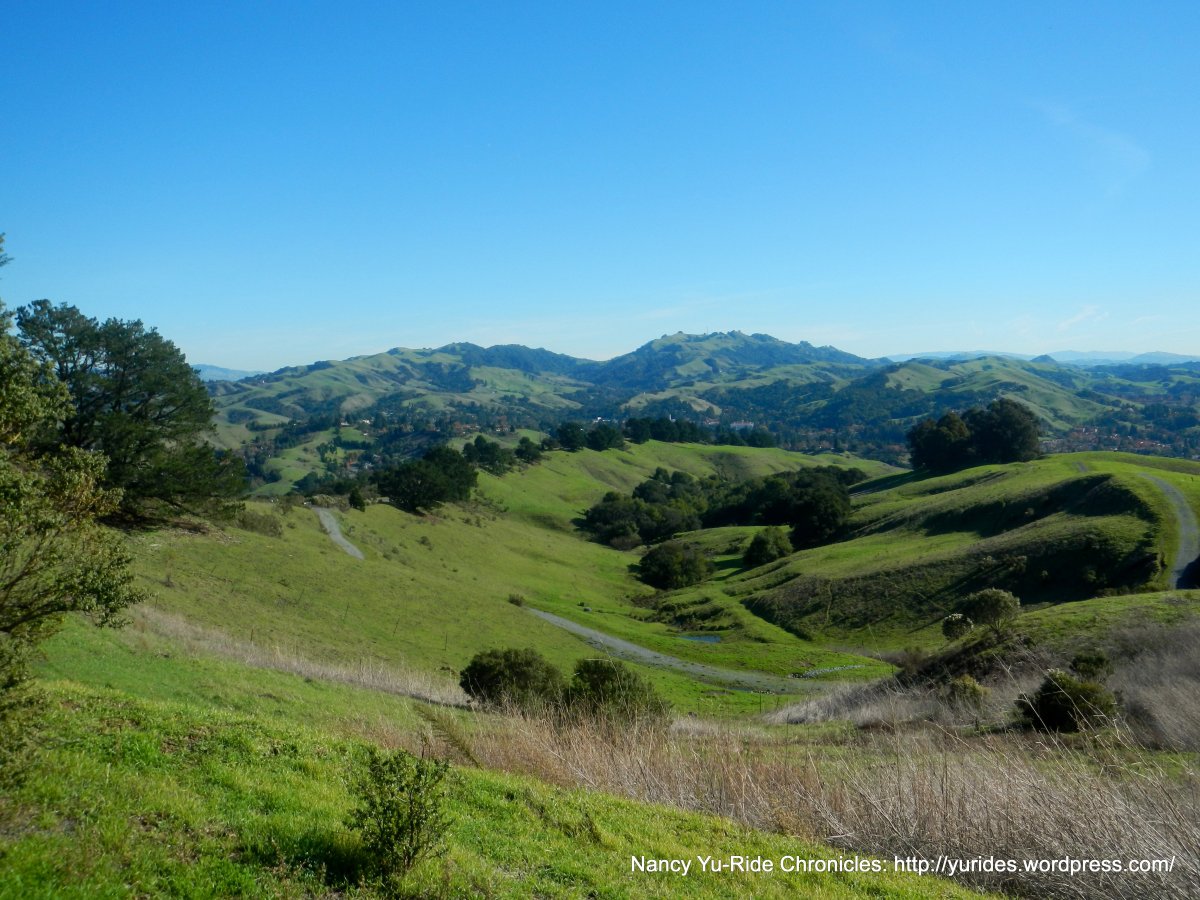
The route continues up south Pinehurst Rd; it’s a short climb with an average grade of 4% and one steeper section on the approach to the top at the Pinehurst Gate Staging Area. The twisty descent down to Canyon Rd is on a narrow two lane road with many tight blind turns and debris.
The turn on Canyon Rd leads us into the town of Moraga. Water and restrooms are available at the Moraga Commons Park.


BLANK
The turn on Donald Dr takes us briefly through a residential neighborhood of Moraga and heads NW along Mulholland Ridge adjacent to the Orinda Oaks Park. The climb starts out gently with grades of 3-4% and increases significantly after you cross the gate. This stair step climb up to the ridge is less than a mile long with gradient ranges of 12-16%. At the point where the road levels out, take a moment to look around and admire the views. The steep climbing continues all the way up to the top at the green water tank. There is a water fountain but no restrooms.
There is a nice picnic area with table and a few benches right at the top of the ridge. The site is perfect for taking in the beautiful vistas of the entire Diablo Valley, the East Bay and Contra Costa hillsides!
We descend Alice Ln & Zander Dr to Rheem Blvd and Glorietta Blvd. We roll along the flats on Moraga Way back to Canyon Rd.
The popular 4 mile climb up Pinehurst Rd from Canyon up to Skyline Blvd is on one of the most beautiful roads in the East Bay. The lower section parallels San Leandro Creek and follows an old railroad grade through gorgeous groves of redwood trees into the town of Canyon. I think this is the first time I’ve actually heard water rushing along the creek! The gentle grade takes you to the start of the climb at the hairpin turn; the first 3/4 mile has an average grade of 4% followed by a steeper half mile section with grades of 9-12%.
From Skyline Blvd, we climb and descend Grizzly Peak Blvd to Golf Course and Shasta Rd back to the Island Picnic Area on Wildcat Canyon.
Thanks to everyone for joining me on this jaunt around the Easy Bay hills out to Mulholland Ridge! It was another fabulous day out on the roads!
13 people in attendance with 1 tandem
VDO Stats:
48.12 Miles with 4453′ of elevation gain *2 extra miles gained from climbing back up Skyline to look for 2 lost riders.
Avg grade: 4%
Max Grade: 16%
Weather: Fabulous! Sunny with clear blue skies. Cool temps ranging from the low to high 50’s
>>>>>>>>>>>>>>>>>>>>>>>>>>>>>>>>>>>>>>>>>>>>>>>>>>>>>>>>>>>>>>>>
In all things of nature there is something of the marvelous. ~Aristotle
>>>>>>>>>>>>>>>>>>>>>>>>>>>>>>>>>>>>>>>>>>>>>>>>>>>>>>>>>>>>>>>>
Click here to view the route map & profile
Follow this route for today’s ride:
