


Saturday, June 15, 2013
View the entire Google Web Album
Today’s flat century begins in the eastern end of Solano County at Rio Vista and winds around the endless network of waterways and bridges along the expansive Sacramento-San Joaquin River Delta. The course passes through the agricultural farmlands, orchard groves, vineyards and wineries of Lodi, Woodbridge, Thornton and Courtland. It continues north along the sloughs to Clarksburg and returns south for a ferry crossing to Grand Island for the run along the Sacramento River back through Isleton and to Rio Vista.
I’m going to keep the narrative pretty simple and identify most of the roads we were on and let the photos speak for themselves.
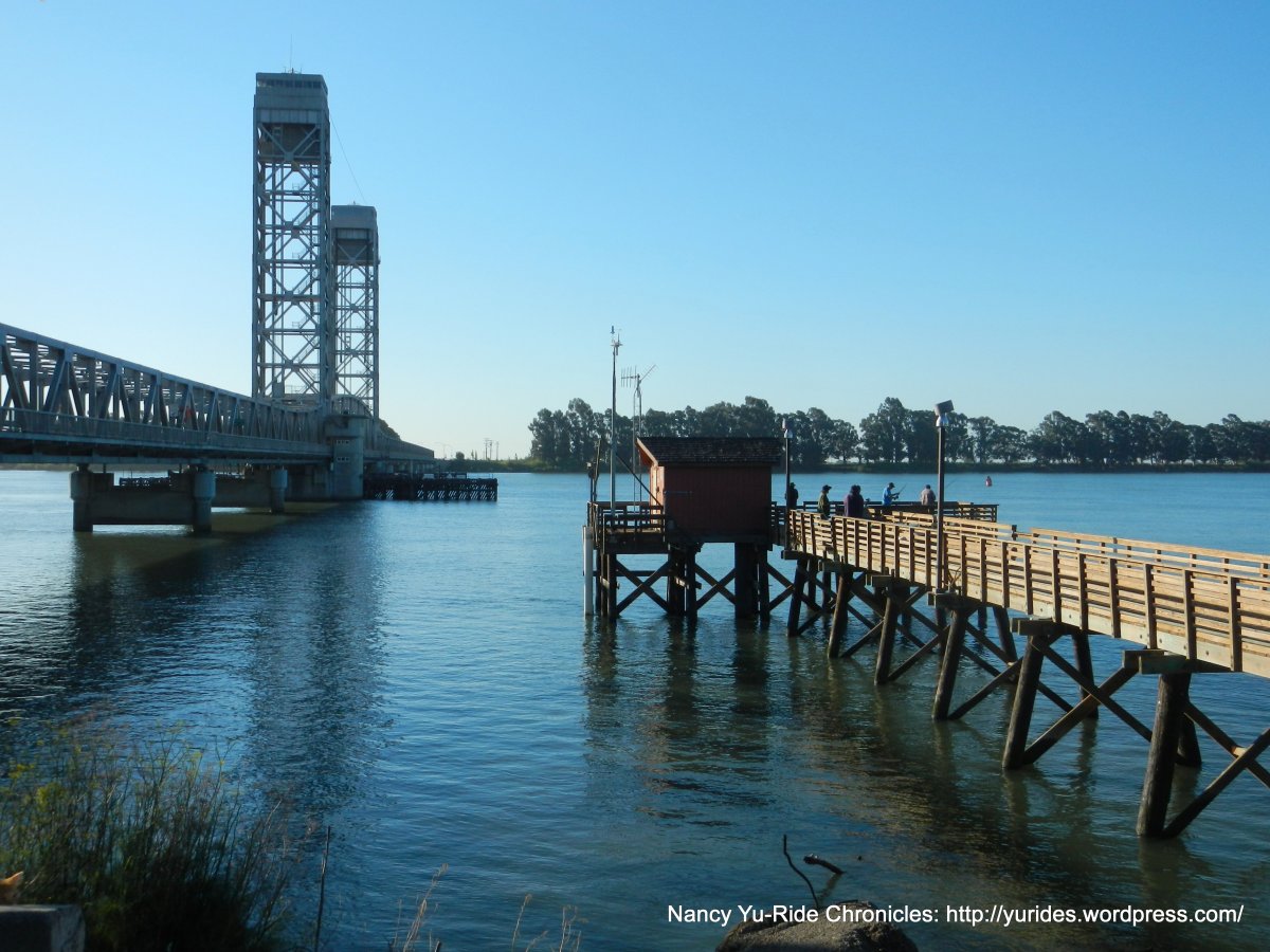
We begin at the Rio Vista Riverbank Fishing Access Area/Waterfront Park. Take a quick stroll along the waterfront for gorgeous views of the sun rising over the Sacramento River and Rio Vista Bridge. Folks are already out on the pier to stake their fishing spot.


CA-160/River Rd runs along the Sacramento River to Iselton and Walnut Grove.


On Walnut Grove-Thornton Rd through the commercial area to the Walnut Grove Bridge crossing.


Blossom Rd goes through the many vineyards and orchards around Beaver Slough.


Peltier Rd crosses over I-5 to N Thornton and Acampo Rd.


The loop around N Ray to W Turner, Davis Rd and Woodbridge Rd tours the wineries and vineyards around Lodi.


Kile Rd and N Thornton Rd takes us through the town of Thornton.


Franklin Blvd crosses the Mokelumnes River to Consumnes River Preserve.


Lambert Rd is a winding road with rich agricultural farmlands on both sides of the levee.


CA-160/River Rd takes us to our lunch stop at the Courtland Market in Courtland.


Cross Paintersville Bridge to the levee crossing over Sutter Slough Bridge.


Rd 143 and Rd 144 winds along Elk Slough above the acres and acres of vineyards around Clarksburg.


Hwy E9/River Rd goes through the wineries and vineyards of Clarksburg.


Babel Slough Rd of course runs along Babel Slough-another waterway.


CA-84/Jefferson Blvd heads south.


Central Ave heads east to Netherland Ave along the west side of Elk Slough.


Waukeena Rd/Rd 145 continues south along Sutter Slough.


Oxford Rd turns west to CA-84 for the Minor Slough Bridge crossing.


Ryer Rd heads SE on Ryer Island for the J Mack cable ferry crossing over Steamboat Slough to Grand Island.


CA-220 heads east to Ryer.


CA-160 crosses the Isleton Bridge and continues to Isleton and Rio Vista.


You would think that riding a flat century would be much easier but it’s not. You have to constantly keep the pedals going round and round, it’s actually more work-there are no down hills to coast on or up hills to get out of the saddle! The use of a Camelbak is highly recommended as there are limited services on the long stretches winding around the levees and sloughs.
We had the levee and island roads to ourselves, the only time we saw other cyclists was at our lunch stop in Courtland. Come on out and enjoy the unique charm and character of the waterscapes and quaint towns of the Delta region! Another thing, the winds will always be with you-usually blowing from the west.
Garmin Stats:
116 Miles with 1322′ of elevation gain
Max elevation: 23′
Weather: WONDERFUL! Sunny clear blue skies with brisk SW winds. Temps ranged from the low 60’s to the high 90’s
>>>>>>>>>>>>>>>>>>>>>>>>>>>>>>>>>>>>>>>>>>>>>>>>>>>>>>>>>>>>>>>>>>
You don’t have to go fast. You just have to go.
>>>>>>>>>>>>>>>>>>>>>>>>>>>>>>>>>>>>>>>>>>>>>>>>>>>>>>>>>>>>>>>>>>

Click here to view the interactive route map & profile
Follow this route for today’s ride:
