Wednesday, July 15, 2015
View the entire Google Web Album
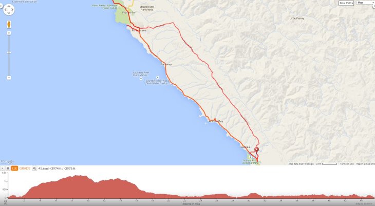
Day 5-Head inland for a climb up Old State Hwy towards Little Rock Mountain and continue ascending along the ridge on Old Stage Rd to Iversen. Descend Ten Mile Cutoff and return west on Eureka Hill/Riverside Dr into Pt Arena. Take Hwy 1 N to Lighthouse Rd for a stop at the Historic Pt Arena Lighthouse. Enjoy the specatcular coastal views before returning along Hwy 1 S for another stop at the Arena Cove Historic District and Wharf. Roll south along Hwy 1 back to Gualala Point Regional Park.
Exit Gualala Point Camground to Hwy 1 N.
Turn right on Old State Hwy; the road name changes to Old State 501 Rd and Old Stage 502 Rd as it steadily climbs through the beautiful shaded woodland with steep grades of 9-13% up to the lower ridge line below Little Red Rock Mountain.
The road bends to the left and name changes to Old Stage Rd as it continues on rolling terrain through the residential community and airfield west of the Little North Fork Gualala River.
Stop at Bower Community Park.
At the Fish Rock Rd junction, the road name changes to Iversen Rd as it continues along the ridge for the next scenic two miles.
At the Y junction-bear right onto Ten Mile Cutoff Rd; the road quickly descends through the pine forest into Hall Gulch. The gradual 3 mile climb out of the gulch is followed by a drop down into a small ranching community as it continues north to Eureka Hill.
The road curves to the left and name changes to Eureka Hill Rd and Riverside Dr as it rolls down from the hill to the coastal meadows at Pt Arena.
keep an e ye out for the African animals roaming the open prairies at the B. Bryan Preserve-we saw a small herd of zebras!
The road drops down onto Main St, turn right and make an immediate left onto Hwy 1 N/School St; it goes pass City Hall and the schools and churches on the way out of Pt Arena.
Hwy 1 heads north along the the boundary of the California Coastal National Monument to Lighthouse Rd; Connecting the Pacific Ocean with the land, the California Coastal National Monument provides unique coastal habitat for marine-dependent wildlife and vegetation on more than 20,000 rocks, islands, exposed reefs, and pinnacles along the California coastline, and 1,665 acres of public land onshore in the Point Arena-Stornetta Unit. The Monument includes public lands along the coast of California, and in the near shore waters of the Pacific Ocean. The off-shore rocks and islands are exposed above mean high tide, and within 12 nautical miles of the mainland along the 1,100 mile California coastline. (http://www.blm.gov/ca/st/en/prog/nlcs/California_Coastal_NM.html)
Turn left onto Lighthouse Rd and travel along on the single lane road through the coastal prairies around Pt Arena-Stornetta Public Lands to the Pt Arena Lighthouse.
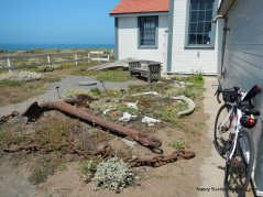
Historic Pt Arena Lighthouse & Museum Area: The Lighthouse is situated on the closest point of land to the Hawaiian Islands in the Continental United States. The point is surrounded on three sides by the Pacific Ocean which keeps the area cool. The Point Arena Lighthouse is set in one of the most spectacular and peaceful surroundings on the northern California coast. The Point Arena tower is the only Pacific West coast lighthouse of significant height (115 feet) that you can climb to the top! Access to the lantern room provides a panoramic view of the rugged California coast and of the ocean. The historic Pt Arena Light Station sits adjacent to the Pt Arena-Stornetts Unit of the California Coastal National Monument; it includes the 23 coastal acres it encompasses, its 115 ft. Lighthouse Tower and its 1896 Fog Signal Building. (http://www.pointarenalighthouse.com/)
Enjoy the majestic coastline!
Exit the Pt Arena Lighthouse back to Hwy 1.
Return south on Hwy 1 to Main St into downtown Pt Arena. There are many options to stop for lunch or a snack at one of the many cafes and markets in town.
The right turn on Port Rd leads down to the Pt Arena Fishing Pier at Arena Cove.
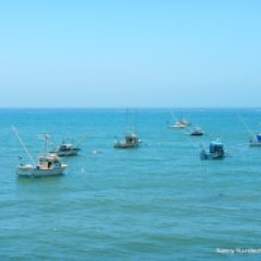
Enjoy the grand views around Arena Cove:
Pt Arena Pier & wharf area:
Reverse your way back up on Port Rd and go straight onto Iversen Ave; the road follows along Pt Arena Creek below the bluffs to Hwy 1.
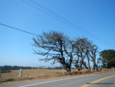
Hwy 1 heading south travels on rolling terrain along the coastal bluffs through the open prairies.
Brief stop at Schooner Gulch vista point:
Hwy 1 S to Iverson Point:
The rolling climbs on Hwy 1 S enters through the pine forests before sweeping down around the Anchor Bay Campgrounds at Fish Rock Gulch.
The road climbs out from the gulch into Anchor Bay, with a couple of pedal strokes in you’re already heading out of town-it’s that small!
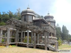
Hwy 1 continues on rolling terrain pass Saint Orres-a hotel/restaurant with Russian-inspired towers.
Another few miles along Hwy 1 and you’re back in Gualala. By now, this looks to be a big town compared to others along the coast. The place is bustling with people and the downtown area has two supermarkets, modern motels, medical offices, hardware stores, shops, restaurants and much more. Although they do not have laundry mat-you’ll have to travel 4 miles north to Anchor Bay.
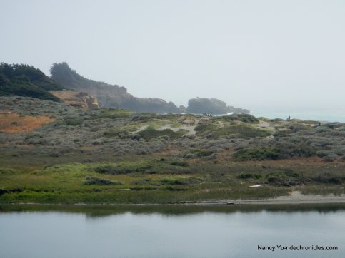
Views of the Gualala River from Gualala:
The short climb on Hwy 1 up to the bridge crossing over the river leads back to Gualala Point Regional Park.
This beautiful ride travels through some of the North Coast’s most breathtaking scenery. It’s a wonderful opportunity to slow down and enjoy the magnificent coastal views at Pt Arena Lighthouse and the quiet country back roads leading up to it-it’s simply gorgeous!
*There is free Wi-fi at the Gualala Point Regional Park Visitor Center
Garmin Stats:
46 Miles with 3635′ of elevation gain
Max elevation: 1347′
Max grade: 13%
Terrain: Hilly with a steep climb
Weather: Sunny and warm with temps ranging from the high 40’s to the high 70’s with NW winds
View the interactive RGPS route map & profile
Follow this route for today’s ride:


