Saturday, September 20, 2014
View the entire Google Web Album
This route heads out from Danville for a loop along the pastoral lands and vineyards around Livermore Valley to Corral Hollow Pass. The ride rolls onto the flatlands in Tracy and returns west through the wind farms on Altamont Pass Rd.
We exit Danville on Camino Tassajara; this road leads out of town and heads south towards the country with wide open pastoral ranch lands and rolling hills through the unincorporated town of Tassajara.
Highland Rd travels east on gentle rolling terrain through “horse country” with boarding ranches and training facilities. The beautiful golden hills are dotted with grazing cattle and scattered barns.
The climb up Collier Canyon Rd is 0.6 mile with an average grade of 4.8%; you’re near the top when you see the old water tower and windmill.
Collier Canyon Rd continues on flat-rolling terrain for the next 4.8 scenic country miles into Alameda County with minimal to no traffic. These golden ranch lands are populated with a few working cattle ranches and a large horse boarding facility.
Old weathered wooden barns are commonplace around this lovely stretch of road.
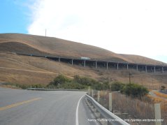
Collier Canyon Rd leads out to Las Positas College and Portola Ave. Portola Ave sits above I-580 with gorgeous views of Livermore Valley!
The turn on Murietta Blvd takes us through the residential neighborhoods along the west side of Livermore to Holmes St and Sycamore Grove Park on Wetmore Rd.
Wetmore Rd and Arroyo Rd runs along the edge of the vineyards that borders the residential subdivisions around Livermore Valley. Here you have the option to ride along the smooth mulit-use path that runs parallel to the main roads.
We head east on Marina Ave; this road cuts through the valley along a small residential ranching community to the Wente vineyards on Wente St.
The mulit-use path on Wente St continues along Concannon Blvd to S Livermore Ave and exits onto Telsa Rd at the intersection with Mines Rd.
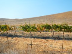
Tesla Rd continues east on gentle rolling terrain with fabulous views of the vineyards and wineries around Livermore Valley to Greenville Rd.
Tesla Rd leads us out of town from the valley to the back country filled with equestrian facilities, a wide scattering of ranches and old wooden barns.
At mile 26, the road tilts up for a climb up to Corral Hollow Pass; it’s 1.9 miles with an average grade of 4.8%.
At the switchback, the road pitches up with 6-8.5% grades up to the summit. Enjoy the summit views!
Tesla Rd sweeps down and around through the canyon before dropping on to the valley floor. The flat terrain follows along the dry Corral Hollow Creek into San Joaquin County at Carnegie State Vehicular Recreation Area.
We stop for lunch at the Motomart; they serve the standard hot snack foods-hot dogs, nachos, hot links, polish dogs and tri-tip sandwiches.
As we continue east, the road name changes to Corral Hollow Rd. The flat rolling terrain stretches through the remote back country pass the LLNL test site and across Elk Ravine to the scenic Black Butte area.
Corral Hollow Rd crosses over I-580 to the far west end of the Central Valley into Tracy.
We jog around the agricultural fields on Valpico to S Lammers and ride along the orchards on W Schulte Rd with a much-needed cold drink stop at 7-Eleven.
Mountain House Pkwy takes us north across I-205 to W Grant Line Rd.
W Grant Line Rd cuts through the wide open valley and crosses over the Delta-Mendota Canal and the California Aqueduct to the busy Mountain House bike bar.
We continue west on Altamont Pass Rd; the rolling climbs for the next 4.4 miles takes us through the vast wind farms to the summit at the Summit Garage.
Altamont Pass Rd drops down along I-580 into Livermore Valley at Northfront Rd.
We meander through the residential neighborhoods on Herman Ave to Scenic and Broadmoor to Dalton and Ames St.
We weave through the scenic open valley on Raymond and Dagnino to May School Rd.
The mile long stretch on N Livermore Rd takes us onto Manning Rd.
The rolling terrain on Highland Rd goes pass the old wooden barns and cattle pens to the white tower at Carneal Rd.
Highland Rd continues along the fenced pastures around Reinstein Ranch before dropping down to the lower valley.
We make our way back to Danville on Camino Tassajara.
This is a scenic remote ride from Livermore over Corral Hollow Pass; you are committed to complete this loop once you drop down into San Joaquin County. It’s good to check the wind conditions before doing this route. Once into Tracy, we got blasted with strong west winds for the entire second half of the ride-WHEW!
Garmin Stats:
76.28 Miles with 3360′ of elevation gain
Max elevation: 1526′
Max grade: 8.5%
Terrain: Flat-rolling with a few low hills
Weather: Sunny and warm with temps ranging from the mid 60’s to the high 80’s. Strong SW winds with 73% humidity
Click here to view the interactive route map & elevation profile
Follow this route for today’s ride:


Hi, nice ride. I was wondering if you had to deal with a lot of trucks on Altamont Pass Road, maybe near the summit where the landfill is? I rode there on a Saturday morning recently and thought it was dangerous with so many large trucks speeding past me. Maybe I was just unlucky that day.
Sara
Sara, We were going up Altamont Pass during the mid afternoon, there was not much traffic at all. I’ve never had problems with trucks passing too fast going in either direction. I ride with a rear mirror and have the habit of doing a courtesy wave to acknowledge any car/truck’s presence behind me and am usually given more than 3 feet when passing. Nancy
LikeLike