Thursday, September 19, 2013
View the entire Google Web Album
Today’s hilly route heads inland for an out and back along Toro Creek Rd followed by the long climbs on Old Creek Rd up to CA-46. The course continues up the east side of Santa Rosa Creek for the steep drop down to the creek followed by a gentle run into Cambria. The return south on CA-1 goes through the seaside town of Cayucas and Morro Bay.
We exit Bay Pines and take Quintana Rd and Main St to Yerba Buena Ave.
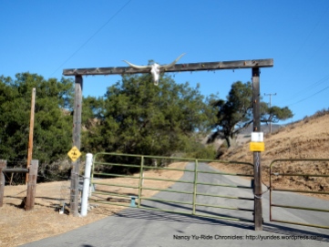
The 0.8 mile on CA-1 N takes us onto Toro Creek Rd for the quiet 7 miles out and back stretch through the tomato farms and ranches. The road dead-ends at the closed gates to a private ranch.
We continue north on CA-1 to Cayucas for the challenging climb up Old Creek Rd; it stretches 9.1 miles from CA-1 up to Green Valley Rd/CA-46 with minimal to no traffic. The first climb up Old Creek Rd begins with gentle grades of 3-4% through the residential neighborhood up towards Monticeto Rd. The gradient increases to ranges of 6-9% as you make your way up to the energy substation and quarry. At the top of the ridge, the road opens up to breathtaking vistas of Whale Rock Reservoir and the surrounding mountains and pastoral lands.
The road continues to climb gently around the reservoir and quickly descends towards the intersection at Santa Rita Rd and Cottontail Creek Rd. The second climb on Old Creek begins with gentle grades for 1.5 miles through avocado and orange farms and hidden ranches.
The next 1.8 miles gets much steeper with an average grade of 9.2% through dense woods and continues on with pitches of 11-13% as you near the top of the ridge at 1418 feet. The rolling terrain for the next few miles leads us out to Santa Rita ranch on Green Valley Rd/CA-46.
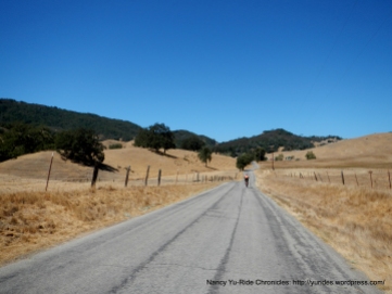
We cross Green Valley Rd/CA-46 for the climb up east Santa Rosa Creek Rd. This remote quiet road runs 16.3 from CA-46 to the other end at Main St in Cambria. It’s a single narrow lane road with virtually no traffic!
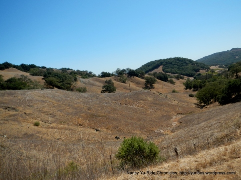
The first climb up to the back ridge is 3/10th of a mile with an average grade of 8.5%, the road opens up to wonderful views of the golden meadows, pastoral lands and foothills around Black Mountain.
After cresting the summit, the road takes us down through the expansive ranchlands and meadows on gentle rolling terrain. Grazing cattle and horses dot the slopes of the golden hillsides.
The second climb is 4/10th of a mile with an average grade of 13.3% up to the summit. Take a second to enjoy the gorgeous views of the mountains of Santa Lucia Range! The road condition drastically deteriorates on the very steep hairpin descent towards the creek.
The road continues to twist and turn on rough bumpy pavement all the way towards the wooded valley to Santa Rosa Creek. Interesting enough, once you enter through the woods you can see that the narrow lane that runs along the creek has been repaved!
The repaved sections of road are pretty sporadic; it switches from good to bad and vice versa. The rolling terrain takes us down to the lower section of Santa Creek Rd through the farmsteads and apple groves around Linn’s Farm Store.
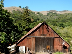
The road continues to wind along Santa Rosa Creek through the open valley pass Stolo Family Winery and Vineyards, open ranchlands and rustic barns. Off to the side of the road, you can’t miss the restored 150 YO white clapboard house and white picket fence.
Santa Rosa Creek ends at the intersection with Main St in Cambria. We stay on Main St to our lunch stop at The French Corner Bakery.
For the return to Morro Bay, we head south on CA-1 for the short climb up towards Harmony. The thick smoky haze in the air is from a control burn happening 50 miles north of San Simeon. I think it’s fair to say we have a tailwind!
The air quality does improve as we get up and over the hill to the other end of the coast. The ocean views are pretty spectacular-you can never get tired of seeing it!
We turn on N ocean Ave into the seaside town of Cayucas; this road goes through the center of town along the waterfront restaurants, hotels, motels and other businesses.
We hop back onto CA-1 S on Cass Ave and take Main St back to Morro Bay.
This is a nice metric century that has a bit of everything; from flat rolling terrain to challenging climbs on quiet back roads. The scenery is beautiful as the landscape transitions from open fields and meadows to dense woods, farmlands, mountains and open ridges to the breathtaking blue waters of the Pacific Ocean! You gotta come and see it!
Garmin Stats:
63.0 Miles with 4268′ of elevation gain
Max elevation: 1874′
Max grade: 13%
Terrain: Hilly
Weather: Fabulous! Sunny and warm with hazy afternoon skies due to a control burn north of San Simeon. Temps ranged from the mid 50’s to the high 80’s. NW winds with 58% humidity
>>>>>>>>>>>>>>>>>>>>>>>>>>>>>>>>>>>>>>>>>>>>>>>>>>>>>>>>>>>>>>>>>>>
Live the life you have imagined!
>>>>>>>>>>>>>>>>>>>>>>>>>>>>>>>>>>>>>>>>>>>>>>>>>>>>>>>>>>>>>>>>>>>
Click here to view the interactive route map & elevation profile
Follow this route for today’s ride:


