Saturday, August 27, 2016
View the entire Google Web Album
This ride heads SE along the scenic Coyote Creek Trail from San Jose to Anderson Lake in Morgan Hill. It continues NE on Thomas Grade and E Dunne Ave to Henry Coe State Park. The climbs offers spectacular views of Anderson Lake, Santa Clara Valley and the dense wilderness surrounding the park.
Begin this ride from Metcalf Park.
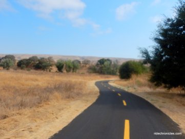
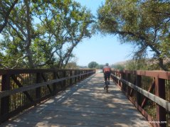
Exit the park and head south on the Coyote Creek Trail, it stretches eleven plus flat miles along Coyote Creek to its southern end at Anderson Lake County Park in Morgan Hill. The trail meanders along Metcalf Park before crossing over the creek to Metcalf Rd.
Cross Metcalf to stay on the trail, it continues SE along Coyote Creek to Coyote Ranch Rd.
Follow the trail along Coyote Ranch Rd out through the lush riparian habitat, it crosses over the creek to the Bailey Ave underpass.
Coyote Creek Trail continues through the open grassland and rolls along the edge of Coyote Creek Golf Club to Coyote Creek Golf Club Dr.
Cross the road to stay on the trail, it meanders around Coyote Creek Park and continues along Coyote Creek.
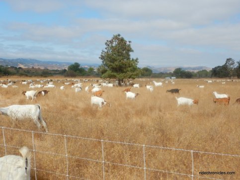
The trail rolls past the Eucalyptus Rest Area full of grazing goats to the Santa Clara County Model Aircraft Skypark.
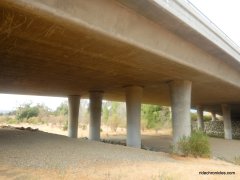
Coyote Creek Trail stays along the creek as it rolls under Hwy 101 to the south end at the Anderson Lake Visitor Center.
The trail exits onto Morning Star Dr. Wiggle along the subdivision on Malaguerra Ave to Cochrane, the road travels eastward along the creek towards the entrance to Anderson Dam.
Cochrane Rd turns southward past the open ranches and plant nursery to E Main St.
Jog along E Main to Hill Rd, it rolls past the orchards and open ranch lands to E Dunne Ave.
Turn left on E Dunne, it goes through the residential neighborhoods to Thomas Grade. The road kicks up to an immediate one mile climb with an average grade of 8.1% and max grade of 16%!
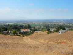
Thomas Grade snakes up around the hillside homes with superb views of Santa Clara Valley!
The road comes to a T junction at E Dunne Ave.
Turn left onto E Dunne, the road goes through a residential neighborhood before dropping down on rolling terrain to the Anderson Lake Bridge.
The road rolls along the east side of the lake to Woodchoppers Picnic Area.
It gently winds above the shoreline to the right hairpin turn at Jackson Ranch.
The road continues with a steady 2.9 mile climb up to the the first high point above Finley Ridge at 2031 feet with an average grade of 7.6% and steep pitches of 10-13%! E Dunne Ave winds around to a steep left hairpin turn.
E Dunne Ave continues snaking up around the hill towards Finely Ridge.
Enjoy the views!
The road drops down to the upper meadows before tilting back up again for a 1.6 mile climb to the second high point at 2511 feet with an average grade of 7.2% and steep pitches of 10-12%!
E Dunne Ave levels out for a short 3/10th of an mile to a cattle guard crossing.
The road kicks up with a half mile climb to the third high point at Pine Ridge-2716 feet with an average grade of 8.5 % and steep pitches of 11-17%!
E Dunne Ave winds around the back ridge before dropping down to the Henry Coe Ranch Visitor Center & Campground Area at 2600 feet. Henry W. Coe State Park protects and preserves 87,000 acres of scenic hills and mountain ridges. This wild, largely undeveloped park welcomes backpackers, equestrians, mountain bikers, day-hikers, and anyone seeking solitude in a nearly untouched setting. Part of the Diablo Range, the park is an amalgam of high ridges, plateaus, and both narrow and open valleys. *1
Henry W. Coe State Park is the largest state park in Northern California, with over 87,000 acres of wild open spaces. The Coe Ranch Campground consists of 20 drive-in sites, located on top of Pine Ridge at 2,600 feet. Once the home of Ohlone Indians, the park is now home to a fascinating variety of plants and animals, including the elusive Mountain Lion. Within Coe Park are the headwaters of Coyote Creek, long stretches of Pacheco and Orestimba creeks and a wilderness area.*2
New Hampshire native Henry W. Coe established the Willow Ranch in the Santa Coe Ranch Visitor Center entrance Clara Valley in 1858 and acquired the San Felipe Ranch in the 1860s. This purchase brought Coe’s sons, Henry Jr. and Charles, into the cattle ranching business. In the late 1880s and 1890s, the brothers acquired 6,000 acres in the Diablo Range. The combined Coe lands became the Pine Ridge Ranch. By 1932 Pine Ridge Ranch was being managed by the daughter of Henry Jr., Sada Sutcliffe Coe Robinson, and her husband Charles. When Henry Jr. died in 1943, Sada’s brother Henry inherited the ranch. In 1949, a year after Henry sold the land to an investor, Sada bought it back. She deeded the ranch to Santa Clara County to be used as a park in 1953. In 1958 the county deeded the land to the State, which established Henry W. Coe State Park. Land that now makes up Henry W. Coe State Park was used for cattle grazing from the 1880s into the 1960s by various cattle ranchers. Still-existing roads, trails, ponds and fencing are among many features dating back to this period in the park’s history. The adjacent Gill-Mustang, Coit and Redfern ranches were also acquired over the years. Henry W. Coe is Northern California’s largest state park. *1
Stop at Coe Ranch Visitor Center.
Coe Ranch Area:
Exit the park and reverse your way back down to Anderson Lake.
Climb out of the lake area and return towards Thomas Grade.
Stay on E Dunne Ave, the sweeping descent leads you back down into the valley. Continue north on Hill Rd and meander around the flat valley orchards on Elm Rd to Half Rd.
Cut through the residential subdivisions along Peet Rd and Eagle View Dr towards Lake Anderson County Park.
Reverse your way back along the Coyote Creek Trail for the return to Metcalf Park.
This out & back ride takes you along Coyote Creek Trail to Anderson Lake and Henry Coe Ranch. You’ll enjoy the flat scenic run along Coyote Creek before hitting the lengthy climbs on Thomas Grade and E Dunne Ave to Pine Ridge. Look around and take in the beautiful vistas along the way!
*1 http://www.parks.ca.gov/pages/561/files/HenryCoeWebBrochure2009.pdf
*2 http://www.parks.ca.gov/?page_id=561
Garmin Stats:
49.45 Miles with 3852′ of elevation gain
Max elevation: 2689′
Max grade: 17%
Terrain: Hilly with a few steep climbs
Weather: Sunny & warm. Temps ranged from the mid 60’s to the low 80’s with SE > NW winds.
View the interactive RGPS route map & profile
Follow this route for today’s ride:
















Hi Nancy !, Beautiful late Summer scenery, Thank you for the pics ! From Michael and Maydene !
LikeLike
Thanks Michael!
LikeLike