Monday. June 30, 2015
View the entire Google Web Album
One of the District’s three oldest parks, Tilden has been called the jewel of the system, and its recreational activities have become a happy tradition for generations of East Bay youngsters. From a carousel ride and a picnic to a swim at Lake Anza and a stroll through the Botanic Garden, Tilden has variety to delight everyone. Yet there are plenty of quiet places in Tilden’s 2,079 acres to shelter the wildlife and preserve natural beauty. Tilden was named for Charles Lee Tilden, first president of the Park District Board of Directors.
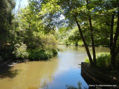
Tilden Nature Area is a 740-acre preserve located just North of Tilden Regional Park. With over 10 miles of hiking trails, the preserve contains a blend of native and introduced plant communities, including oak/bay woodlands, grasslands, eucalyptus forests, and streams. Hikes range from the leisurely, self-guided Jewel Lake Nature Trail to a vigorous climb up Wildcat Peak (elevation 1,211′) for panoramic, San Francisco Bay views. A 750-foot boardwalk through the woods leads to Jewel Lake, a historic reservoir and waterworks, and a peaceful place to watch wildlife. (http://www.ebparks.org/Page158.aspx)
This hike drops down on Meadow Canyon Trail to the Little Farm at Tilden Nature Area and meanders through the lush wood along Wildcat Creek and Jewel Lake. Continue up Wildcat Peak Trail to the summit at the stone lookout point before descending and climbing back up Laurel Canyon to Nimitz Way for the return to Inspiration Point.
Begin this hike from Nimitz Gate at Inspiration Point in Berkeley.
At the Curran Trail junction: turn left for the gentle descent through eucalyptus and pine to the next trail junction at Meadows Canyon.
Mile 0.17-at Meadows Canyon Trail junction: turn right-the broad trail drops down underneath the eucalyptus groves to the open grassland with ridge top views of the Berkeley Hills. The trail continues downhill through the woodland to a trail gate at Lone Oak Picnic Area.
Mile 1.6-at the trail gate: turn right and head uphill on the paved road to the next trail gate. Continue straight onto Loop Rd-this fire road travels under the shade of the eucalyptus groves towards the Nature Area.
Mile 1.9-at the Visitor Center trail junction: turn left and head west through the eucalyptus forest and creek crossing.
Mile 2.0-turn left at the trail junction and follow the path towards the Visitor Center. You will pass a small pond before arriving behind the service shed-follow the trail out to the open meadow at the Visitor Education Center.
Cut across the meadow to the Little Farm at Tilden Nature Area. Take the time to use the facilities and walk around the farm area. The Little Farm was built in 1955 and features a variety of farm animals including cows, sheep, goats, rabbits, chickens and pigs. Several heritage breeds are preserved here, including Milking Shorthorn Cattle. Visitors are welcome to bring lettuce or celery (but nothing else) to feed the animals. (http://www.ebparks.org/Page158.aspx)
Exit the farm area and follow the main road towards the parking lot to the Jewel Lake junction-turn right and follow the path across Wildcat Creek to the next junction.
Mile 2.1-at the Packrat/Memory Trail/Jewel Lake junction: turn right onto Lower Packrat Trail. The narrow trail travels through and under the beautiful dense brush and oak/bay woodland along Wildcat Creek towards Jewel Lake.
At the Jewel Lake junction: turn right and walk underneath the redwoods along the SW side of the lake to the reservoir crossing.
Mile 2.5-at the end of the wooden bridge: turn right and continue around the NE side of Jewel Lake to the 750 foot boardwalk-the trail meanders through the gorgeous woods along Wildcat Creek.
Mile 2.8-the boardwalk exits onto Wildcat Creek Trail-turn left and head north on the wide fire road.
Mile 3.0-at the Jewel Lake/Sylvan/Wildcat Peak Trail junction: turn right and go uphill through the eucalyptus forest.
Mile 3.1-at the Sylvan/Peak Trail junction; go left and continue under the shade of the eucalyptus forest.
Mile 3.2-at the Peak Trail/Nimitz Way junction: go straight onto Peak Trail. The trail continues to uphill through the woods before emerging out along the side of the hill.
Enjoy the magnificent views!
Wildcat Peak Trail winds up through thick brush and chaparral towards Wildcat Peak.
Mile 4.1-at the Peak Trail/Nimitz way junction: turn left and go uphill to the stone lookout point at Wildcat Peak.
Enjoy the phenomenal panoramic summit vistas! You can see San Pablo Reservoir, Briones Reservoir, Briones Hills, San Pablo Ridge, El Sobrante Ridge and the majestic Mt Diablo to the east. San Pablo Bay pops out from the north. To the west, you can see the expanded view of San Francisco Bay and its famous landmarks: Mt Tamalpais, the Golden Gate Bridge, Angel Island, the Richmond Bridge, the Bay Bridge and San Francisco skyline-WOW!
Return downhill to the junction and go straight to stay on Wildcat Peak Trail. Follow the trail downhill for a stop at the Berkeley Rotary Peace Grove-giant sequoias planted by the club to honors individuals and organizations who have fostered world peace.
Mile 4.4-at the Peak Trail junction/unsigned Laurel Canyon Rd: turn right and head downhill towards the woods.
Mile 4.6-at Laurel Canyon/Loop Rd junction: turn right onto Laurel Canyon Rd and continue downhill.
Mile 4.8-at Laurel Canyon Rd/ Laurel Canyon Trail junction: go straight to stay on Laurel Canyon Rd. The road winds downhill to Loop Rd.
Mile 5.1-at Loop Rd/Visitor Center junction: turn left onto Loop Rd.
Mile 5.2-at Laurel Canyon/Nimitz Way junction: turn left and go uphill under the canopy of the dense woodland.
Mile 5.4-at the Pine Tree/Laurel Canyon Trail junction: go straight to stay on Laurel Canyon Trail. Continue winding along canyon for the gentle uphill through the gorgeous oak/bay woodland.
Mile 5.5-at the Laurel Canyon/Nimitz way junction; turn right to stay on Laurel Canyon Trail to Nimitz Way. The trail ascends through the woods before exiting through the lush riparian landscape to the upper ridge.
Mile 5.9-at the Laurel Canyon Rd/Trail junction: turn right onto Laurel Canyon Rd-the road enters the Tilden Nature Area and comes to a T at Nimitz Way.
Mile 6.0-turn right onto Nimitz Way. The paved road winds gently uphill along the eastern edge of Tilden Park with several scenic vista areas.
The road leads back to Nimitz Gate at Inspiration Point.
This a a fabulous hike with splendid ridge top views and gentle undulating climbs through the dense park woodlands. The stop at Wildcat Peak is “a must”-the summit vistas are spectacular! You’ll enjoy the animals at the Little Farm and the beautiful walk along Jewel Lake and Wildcat Creek!
Stats:
7.5 Miles with 1223′ of elevation gain
Time: 4 hours with a stop at the Little Farm and Wildcat Peak Lookoout
Hike: Moderate
Parking: No fee at Inspiration Point on Wildcat Canyon in Berkeley
Pit toilets available inside gate on Nimitz Way-NO WATER
NO DOGS allowed in Tilden Nature Area
Bring plenty of water & food/snacks-Facilities available at Lone Oak Picnic Area, Little Farm and Jewel Lake
Weather: Sunny and warm with clear blue skies. Temps ranged from the high 60’s to high70’s with SW winds.


New email address for Elia Racah: eliaracah@gmail.com
Sent from my iPhone
>
LikeLike
Beautiful pictures and looks like a wonderful hike, thanks!
LikeLike
Thanks Carlene, The hike up to Wildcat Peak is well worth it-the views are gorgeous! Nancy
LikeLike